

Monthly Archives: February 2017
Dynamic Plots for Combined Wave Observations and Forecast
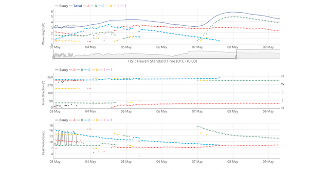
Posted February 15, 2017In response to user feedback, PacIOOS is now featuring new dynamic data plots that combine PacIOOS’ wave buoy observations with wave forecast data (see example for Waimea Bay). Spectral...
Higher Resolution NCEP GFS Weather Forecast
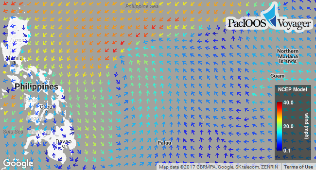
Posted February 07, 2017In addition to the 0.5° (~50-km) NCEP Global Forecast System (GFS) weather forecast, Voyager now offers a higher resolution Pacific subset of NCEP GFS at 0.25° (~25-km). This numerical...


