

Yearly Archives: 2019
Meeting Regional, Coastal and Ocean User Needs With Tailored Data Products: A Stakeholder-Driven Process
Posted June 07, 2019As part of the publication series OceanObs’19: An Ocean of Opportunity, the article Meeting Regional, Coastal and Ocean User Needs With Tailored Data Products: A Stakeholder-Driven Process was recently...
Citizen Scientists Model Validation in West Maui
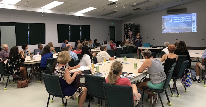
Posted May 30, 2019PacIOOS, in conjunction with the Hawaiʻi Sea Grant King Tides Project, conducted two workshops on Maui (in Lahaina and Kīheī) to mobilize citizen scientists to participate in photo documentation...
From the Oceans to the Cloud: Opportunities and Challenges for Data, Models, Computation and Workflows
Posted May 21, 2019As part of the publication series OceanObs’19: An Ocean of Opportunity, the article From the Oceans to the Cloud: Opportunities and Challenges for Data, Models, Computation and Workflows was...
New ocean acidification monitoring station in American Samoa
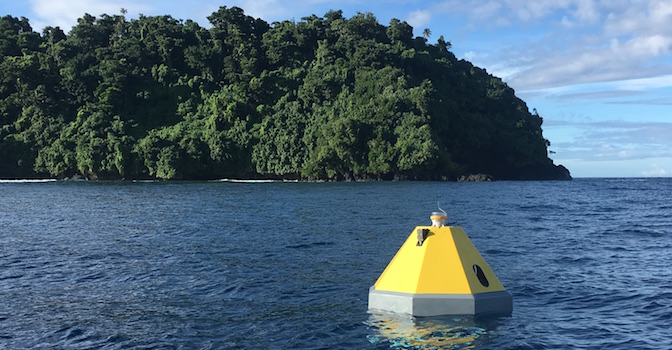
Posted May 21, 2019NOAA, the Pacific Islands Ocean Observing System (PacIOOS), and partners have launched a new buoy in Fagatele Bay within the National Marine Sanctuary of American Samoa to measure carbon...
Tanapag Wave Buoy Back in the Water
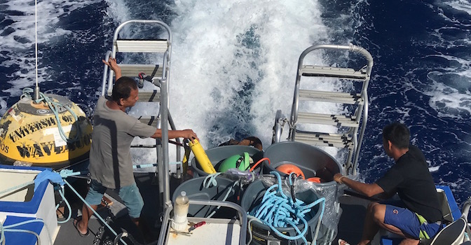
Posted May 15, 2019On May 10th, PacIOOS redeployed its wave buoy outside of Tanapag, Saipan. The yellow buoy is located about 5 miles offshore and provides valuable wave and ocean information. Data...
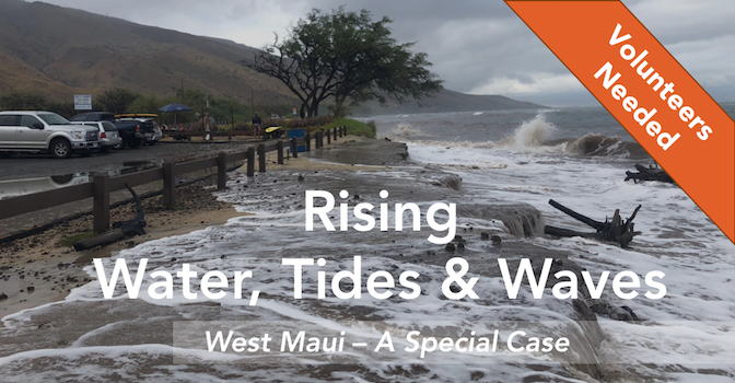
Citizen Scientists Training Session
Posted May 13, 2019Please join us for two informational and interactive evenings to learn more about rising sea levels, King Tides, and wave run-up. Participants will also find out how to help...
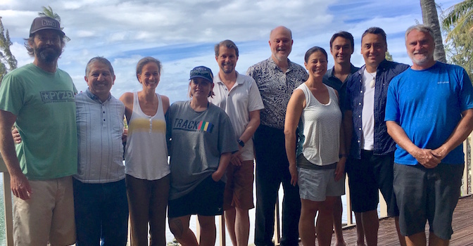
2019 Executive Committee Meeting
Posted April 26, 2019Members of the PacIOOS Executive Committee came together on Oʻahu this month for their annual meeting. The Executive Committee consists of five members from the PacIOOS Governing Council, representing...
Forecasts of Wave-Induced Coastal Hazards in the United States Pacific Islands: Past, Present, and the Future
Posted April 06, 2019As part of the publication series OceanObs’19: An Ocean of Opportunity, the article Forecasts of Wave-Induced Coastal Hazards in the United States Pacific Islands: Past, Present, and the Future...

New PacIOOS Operations Coordinator
Posted March 29, 2019PacIOOS is excited to welcome Chip Young onboard our team as the PacIOOS Operations Coordinator. This newly established position will be responsible for coordinating and managing day-to-day PacIOOS operations,...
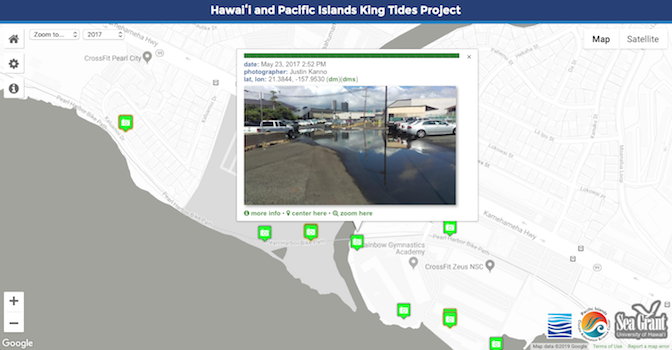
Explore King Tides Photo Submissions
Posted March 26, 2019With the support of dedicated citizen scientists, the Hawaiʻi and Pacific Islands King Tides Project has collected more than 2,600 photos throughout the past years. Led by the University...


