Dataset Identifier:
hi_himb_all_cramp_sites
Citation:
Citation Information:
Title: Coral Reef Assessment and Monitoring Program (CRAMP) Study Sites: Main Hawaiian Islands
Originator: Ku'ulei S. Rodgers
Originator: Paul L. Jokiel
Originator: Hawaii Institute of Marine Biology (HIMB)
Publication Date: January 25, 2016
Description:
Abstract:
The Hawaii Coral Reef Assessment and Monitoring Program (CRAMP) was created during 1997-98 by leading coral reef researchers, managers and educators in Hawaii. The initial task was to develop a statewide network consisting of over 30 long-term coral reef monitoring sites and an associated database. Upon completion of the monitoring network the focus was expanded to include rapid quantitative assessments and habitat mapping on a statewide spatial scale. Today the emphasis is on using these tools to understand the ecology of Hawaiian coral reefs in relation to other geographic areas.
CRAMP study sites, including all areas of concern designated by the State of Hawaii Division of Aquatic Resources (DAR), were selected from throughout the State of Hawaii based on information provided by a wide spectrum of managers, scientists, and educators. These sites represent a full range of reef habitats subjected to various degrees of anthropogenic influences ranging from severely impacted to relatively pristine sites held in conservation status.
CRAMP is based at the Hawaii Institue of Marine Biology (HIMB) of the University of Hawaii at Manoa and is led by Dr. Ku'ulei S. Rodgers (kuuleir@hawaii.edu). For further information, please see: http://cramp.wcc.hawaii.edu
Purpose: PacIOOS provides timely, reliable, and accurate ocean information to support a safe, clean, productive ocean and resilient coastal zone in the U.S. Pacific Islands region.
Spatial Domain:
Bounding Coordinates:
West Bounding Coordinate: -160.16352°
East Bounding Coordinate: -155.01815°
North Bounding Coordinate: 22.22681°
South Bounding Coordinate: 19.26997°
Keywords:
Theme:
Theme Keyword Thesaurus: GCMD Science Keywords
Keyword: Earth Science Biosphere Aquatic Ecosystems Reef Habitat
Keyword: Earth Science Human Dimensions Environmental Governance/Management Environmental Assessments
Keyword: Earth Science Oceans Coastal Processes Coral Reefs
Keyword: Earth Science Oceans Marine Environment Monitoring
Place:
Place Keyword Thesaurus: GCMD Location Keywords
Place Keyword: Continent North America United States Of America Hawaii
Place Keyword: Ocean Pacific Ocean Central Pacific Ocean Hawaiian Islands
Access Constraints:
None
Use Constraints:
Use Limitation: The data may be used and redistributed for free but is not intended for legal use, since it may contain inaccuracies. Neither the data Contributor, University of Hawaii, PacIOOS, NOAA, State of Hawaii nor the United States Government, nor any of their employees or contractors, makes any warranty, express or implied, including warranties of merchantability and fitness for a particular purpose, or assumes any legal liability for the accuracy, completeness, or usefulness, of this information.
Point of Contact:
Contact Information:
Contact Organization Primary:
Contact Organization: Hawaii Institute of Marine Biology (HIMB)
Contact Person: Ku'ulei S. Rodgers
Contact Electronic Mail Address: kuuleir@hawaii.edu
Data Set Credit:
The Pacific Islands Ocean Observing System (PacIOOS) is funded through the National Oceanic and Atmospheric Administration (NOAA) as a Regional Association within the U.S. Integrated Ocean Observing System (IOOS). PacIOOS is coordinated by the University of Hawaii School of Ocean and Earth Science and Technology (SOEST).
Browse Graphic:
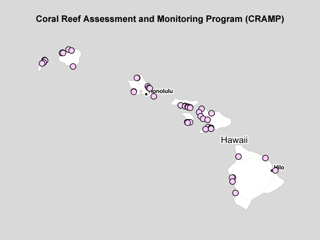
View full image
Browse Graphic File Name: http://www.pacioos.hawaii.edu/metadata/browse/hi_himb_all_cramp_sites.png
Browse Graphic File Description:
Sample image.
Browse Graphic File Type: PNG
Back to Top
