

New Ocean Circulation Forecast for Kāneʻohe
New Ocean Circulation Forecast for Kāneʻohe
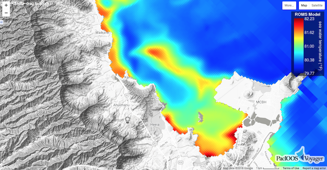
Posted May 21, 2018PacIOOS’ Regional Ocean Modeling System (ROMS) now provides a new high-resolution grid for Kāneʻohe (approximately 100-m resolution) and the surrounding area along Oʻahu’s windward shore (1.5-km resolution). The model generates 3-day forecasts for ocean currents, water temperature, and salinity. This daily forecast with hourly output allows users to explore values throughout the entire water column, from the surface to the ocean floor. All data can be accessed online on the PacIOOS website and on PacIOOS Voyager. PacIOOS ROMS is available for various areas and grid sizes in Hawaiʻi, the Mariana Islands, and Samoa.


