

Ocean Acidification Monitoring: CO2 Buoys
Ocean Acidification Monitoring: CO2 Buoys
Posted July 11, 2014Fundamental changes in sea water chemistry are occurring throughout the world’s oceans. Humankind’s industrial and agricultural activities have increased the amount of CO2 in the atmosphere. Some of this CO2 gets absorbed by the ocean, leading to ocean acidification. Even small changes in acidity can negatively impact marine organisms with calcium carbonate (CaCO3) shells or skeletons—such as corals, oysters, clams, and mussels.
PacIOOS Voyager now contains a new “ocean acidification” category, which provides near real-time monitoring of atmospheric and oceanic carbon dioxide (CO2) levels at 13 moored buoys across the insular Pacific. These three-hourly data are obtained from NOAA’s Pacific Marine Environmental Laboratory (PMEL) Carbon Program. We include five CO2 buoys in Hawaiʻi, seven Tropical Atmosphere Ocean (TAO) buoys along the equatorial Pacific, as well as a buoy in Chuuk Lagoon of the Federal States of Micronesia (FSM).
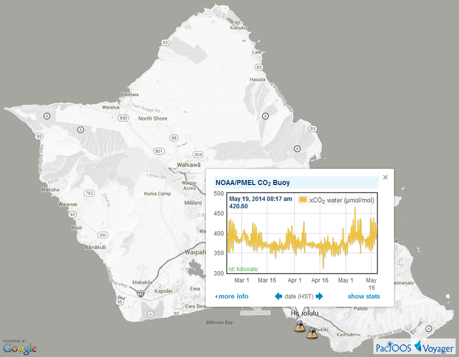
Voyager screenshot of sea water CO2 at Kilo Nalu Offshore Observatory, near Waikīkī, Oʻahu:
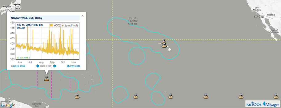
Screenshot of insular Pacific PMEL CO2 buoys included in Voyager, with atmospheric CO2 plotted at Chuuk, FSM (click here for larger image):
In addition to monitoring xCO2 (mole fraction), some of the buoys measure additional parameters, such as sea level pressure, water temperature, and salinity. In a few cases, pH is also directly measured in situ. Records extend as far back as 2003 in some cases and may continue up to the present day. However, data availability differs at each buoy and may lag by several months. This network is essential for characterizing the natural variability and secular trends in the oceanic carbon cycle.
As with Voyager’s other dynamic near real-time categories—including waves, water levels, water quality, and water resources—map marker icons can be color-coded according to the latest measurements. Clicking on a marker produces a pop-up window with an interactive time series plot, along with options to go backwards in time. To download these data, users must contact PMEL.
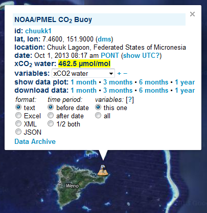
Example of further options and utilities provided when clicking on “more info” in the pop-up window:
PMEL cautions users that these data are near real-time and have not been post-calibrated or quality controlled. For scientific usage, please access the quality controlled dataset available from the Carbon Dioxide Information Analysis Center (CDIAC).
For further information, please visit:


