

Higher Resolution NCEP GFS Weather Forecast
Higher Resolution NCEP GFS Weather Forecast
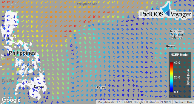
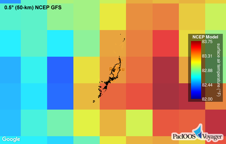
Posted February 7, 2017In addition to the 0.5° (~50-km) NCEP Global Forecast System (GFS) weather forecast, Voyager now offers a higher resolution Pacific subset of NCEP GFS at 0.25° (~25-km). This numerical weather prediction model provides 8-day, 3-hourly forecasts of the following surface variables: air temperature, wind, rain, humidity, and air pressure. See comparison below.
Voyager screenshot of higher resolution 0.25° NCEP GFS air temperature around Palau:

Voyager screenshot of lower resolution 0.5° NCEP GFS air temperature around Palau:
This higher resolution NCEP GFS dataset is now available on the PacIOOS website (temperature, wind, rain) and in the PacIOOS data servers, including THREDDS Data Server (TDS), Live Access Server (LAS), and ERDDAP. Through these data servers, interoperable data access is provided via OPeNDAP, Web Map Service (WMS), Web Coverage Service (WCS), NetCDF Subset Service (NCSS), and other services. Formal metadata can be found here. These data are downloaded and aggregated daily from U.S. National Oceanic and Atmospheric Administration (NOAA) National Centers for Environmental Prediction (NCEP): click here for further information.


