

Northwestern Hawaiian Islands Wave Model
Northwestern Hawaiian Islands Wave Model
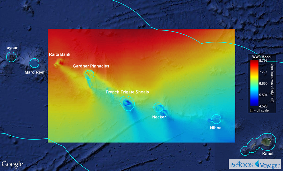
Posted October 3, 2014Voyager now includes a new high resolution regional wave model for the Northwestern Hawaiian Islands (NWHI) region, home of the Papahānaumokuākea Marine National Monument. This WaveWatch III (WW3) 7.5-day hourly forecast predicts significant wave height, wave direction, and wave period at approximately 5-km or 0.05-degree resolution. Its spatial coverage includes Nihoa Island, Necker Island, French Frigate Shoals, Gardner Pinnacles, and Raita Bank.
Voyager screenshot of WW3 NWHI for October 3, 2014 9:00 AM HST; EEZ and islands outlined in blue (click here for larger image):
These model results are produced by Dr. Kwok Fai Cheung of the Department of Ocean and Resources Engineering (ORE) in the School of Ocean and Earth Science and Technology (SOEST) at the University of Hawaiʻi at Mānoa and have been added today to the PacIOOS data servers. Formal metadata available here. These complement our existing global and regional WW3 forecasts (Hawaiian Islands, Mariana Islands, Samoa) as well as our SWAN collection in Hawaiʻi, Guam, and Tutuila.
These model results were generated as part of an academic research project. They provide a scientific prediction of current and future conditions. As with any forecast, however, accuracy cannot be guaranteed and caution is advised. While considerable effort has been made to implement all data components in a thorough, correct, and accurate manner, numerous sources of error are possible.


