

Samoa Wave Models
Samoa Wave Models
Posted February 19, 2013Voyager now includes two new high resolution regional wave models for the Samoa region:
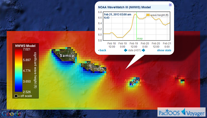
- NOAA WaveWatch III (NWW3) at approximately 5-km or 0.05-degree resolution for the Samoan Islands region surrounding both Western Samoa and American Samoa; and
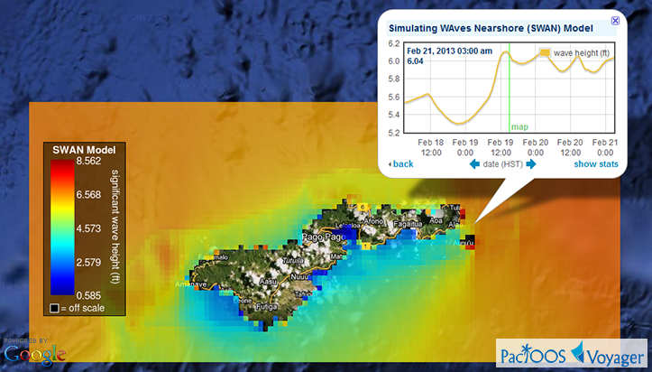
- Simulating WAves Nearshore (SWAN) at approximately 500-m resolution for Tutuila Island in American Samoa.
Each of these new datasets come from Dr. Kwok Fai Cheung of the Department of Ocean and Resources Engineering (ORE) in the School of Ocean and Earth Science and Technology (SOEST) at the University of Hawaiʻi at Mānoa and have been added today to the PacIOOS data servers. These complement our existing global and regional NWW3 forecasts (Hawaiian Islands, Mariana Islands) as well as our SWAN collection in Hawaiʻi and Guam.
Voyager screenshots of NWW3 Samoa (top) and SWAN Tutuila (bottom):
These model results were generated as part of an academic research project. They provide a scientific prediction of current and future conditions. As with any forecast, however, accuracy cannot be guaranteed and caution is advised. While considerable effort has been made to implement all data components in a thorough, correct, and accurate manner, numerous sources of error are possible.


