

Voyager Usability Improvements
Voyager Usability Improvements
Posted January 26, 2015Based on user feedback, we have implemented several improvements to Voyager’s user interface (UI) design. We occasionally hear that the number of configurable options in some of Voyager’s map categories can be overwhelming, particularly to new users. In an effort to simplify things, many of these features are now moved under a “map options” sub-folder. Often these features are advanced capabilities for tweaking the color, style, and/or behavior of the data display: nice to have in specialized cases but not critical for using the data. (And if you are ever confused about one of the map options, please note that many provide usage tips in a pop-up window when you click on them.)
Furthermore, we now visually distinguish the various datasets and their options using different shades of background colors. Because of the large number of options related to certain overlays, this was done to improve readability. In order to implement this, we also removed the wave image from behind the menu bar, which some users thought distracted from the text anyhow. As always, if you have questions or further suggestions for improvement, please do not hesitate to contact us at info@pacioos.org.
Voyager screenshot of the “waves” menu: a.) old style, b.) new style, c.) after clicking on “PacIOOS wave buoys”, d.) after expanding the new “map options” folder for the waves category:
| a.) | 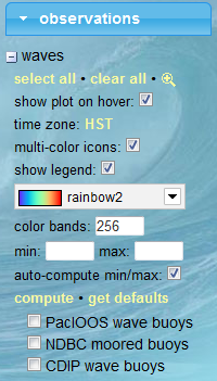 |
b.) |  |
| c.) | 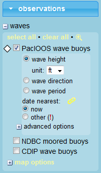 |
d.) | 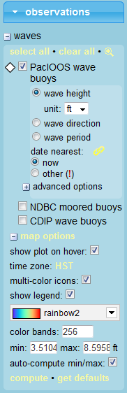 |
Voyager screenshot of the “surface currents (HFR)” menu: a.) old style, b.) new style, c.) after expanding the “map options” folder:
| a.) | 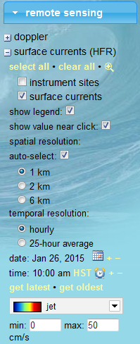 |
b.) | 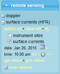 |
c.) | 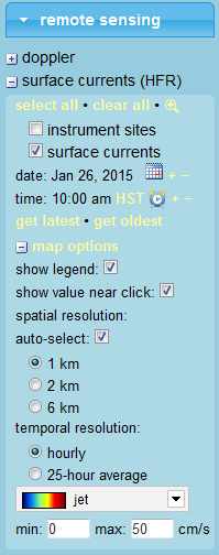 |
Voyager screenshot of the “ocean forecast” menu: a.) old style, b.) new style, c.) after expanding the “map options” folder:
| a.) |  |
b.) | 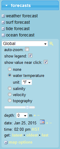 |
c.) | 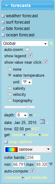 |


