Wind and Currents: Display Improvements
Wind and Currents: Display Improvements
Posted July 3, 2013We have completed a couple of improvements to our wind and ocean current overlays in the following categories: satellite data, weather forecasts, tide forecasts, and ocean forecasts.
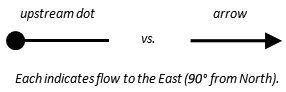
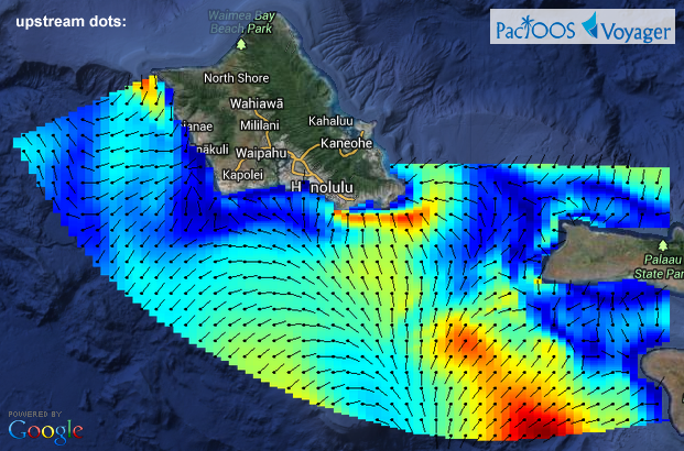
Owing to an update in the underlying THREDDS/ncWMS map service, the default display for vector velocity fields is now black arrows (direction of motion) on a graded color background (magnitude/speed of motion). Prior to now these maps showed “upstream dots”, which some users found confusing and counter-intuitive. As the figure below illustrates, an upstream dot has no arrowhead at the tip of the vector—instead, it places a dot at its base:
Example Voyager screenshots of Oʻahu ROMS forecast of ocean currents before (upstream dots) and now (arrows):
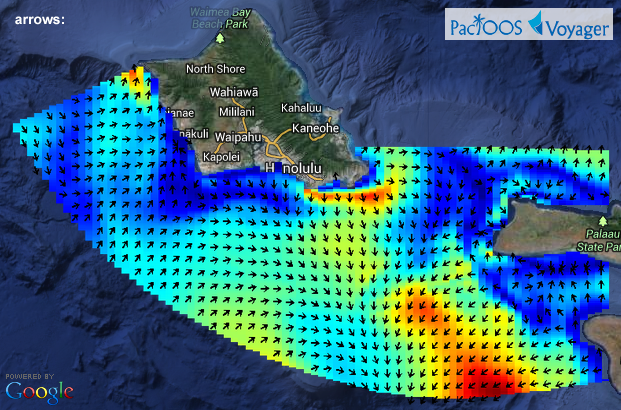
As before, users can also select from a set of alternative vector styles: color graded arrows (thin, thick, or outlined) or wind barbs on a transparent background.
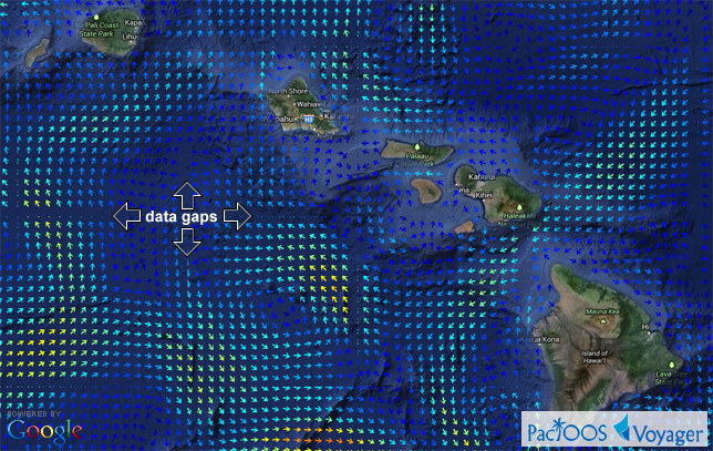
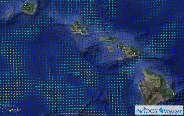
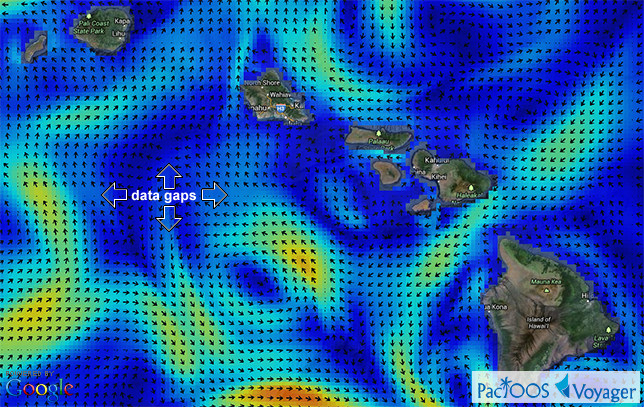
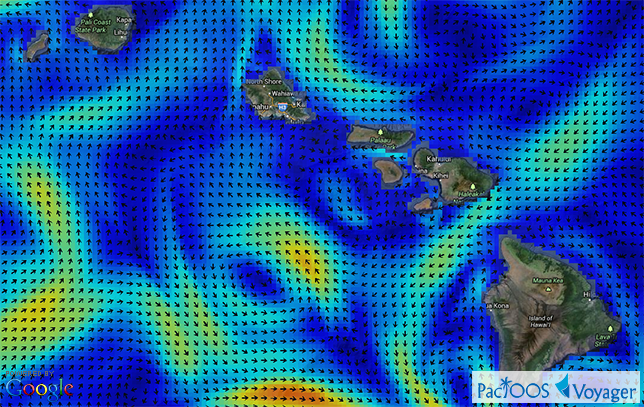
The second improvement to our wind and ocean current overlays is to remove the data gaps at tile boundaries. These overlays are constructed from individual square images (map tiles) that are composited on-screen to build an overlay covering the appropriate spatial bounds and zoom level. Before now, data gaps would appear at the edges of each tile image where the vector icons were prematurely cropped by the underlying ncWMS library, resulting in a lattice appearance in the overlay. We have implemented a workaround wherein we request slightly larger tiles than necessary for padding and then buffer these down to the appropriate size prior to display. The data gaps are now gone and vector overlays are displayed seamlessly.
Example Voyager screenshots of Hawaiʻi ROMS forecast of ocean currents before (top) and after (bottom) gap removal:
Same as the above comparison but using a different vector style (color graded arrows on transparent background):