Dataset Identifier:
as_dw_manall_vilbndrs
Citation:
Citation Information:
Title: Village Boundaries - Manua, American Samoa
Originator: Dwan J. Wright
Publication Date: January 25, 2016
Description:
Abstract:
Village boundaries of Manu'a, American Samoa: Ofu, Olosega and Ta'u.
Purpose: PacIOOS provides timely, reliable, and accurate ocean information to support a safe, clean, productive ocean and resilient coastal zone in the U.S. Pacific Islands region.
Spatial Domain:
Bounding Coordinates:
West Bounding Coordinate: -169.688°
East Bounding Coordinate: -169.419°
North Bounding Coordinate: -14.155°
South Bounding Coordinate: -14.273°
Keywords:
Theme:
Theme Keyword Thesaurus: GCMD Science Keywords
Keyword: Earth Science Human Dimensions Boundaries Administrative Divisions
Keyword: Earth Science Human Dimensions Boundaries Political Divisions
Place:
Place Keyword Thesaurus: GCMD Location Keywords
Place Keyword: Ocean Pacific Ocean South Pacific Ocean Polynesia American Samoa Manua
Place Keyword: Ocean Pacific Ocean South Pacific Ocean Polynesia American Samoa Ofu
Place Keyword: Ocean Pacific Ocean South Pacific Ocean Polynesia American Samoa Olosega
Place Keyword: Ocean Pacific Ocean South Pacific Ocean Polynesia American Samoa Tau
Access Constraints:
None
Use Constraints:
Use Limitation: The data may be used and redistributed for free but is not intended for legal use, since it may contain inaccuracies. Neither the data Contributor, University of Hawaii, PacIOOS, NOAA, State of Hawaii nor the United States Government, nor any of their employees or contractors, makes any warranty, express or implied, including warranties of merchantability and fitness for a particular purpose, or assumes any legal liability for the accuracy, completeness, or usefulness, of this information.
Point of Contact:
Contact Information:
Contact Organization Primary:
Contact Organization: Oregon State University (OSU)
Contact Person: Dwan J. Wright
Contact Electronic Mail Address: dwright@esri.com
Data Set Credit:
The Pacific Islands Ocean Observing System (PacIOOS) is funded through the National Oceanic and Atmospheric Administration (NOAA) as a Regional Association within the U.S. Integrated Ocean Observing System (IOOS). PacIOOS is coordinated by the University of Hawaii School of Ocean and Earth Science and Technology (SOEST).
Browse Graphic:
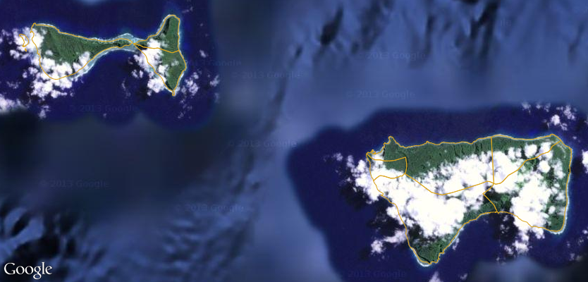
View full image
Browse Graphic File Name: http://www.pacioos.hawaii.edu/metadata/browse/as_dw_manall_vilbndrs.png
Browse Graphic File Description:
Sample image.
Browse Graphic File Type: PNG
Back to Top
