

Launch of new PacIOOS Website
Launch of new PacIOOS Website
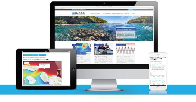
Posted August 20, 2016We are proud to announce the launch of the new PacIOOS website at http://pacioos.org. The goal of the new website is to further PacIOOS’ mission to empower ocean users, decision-makers, and stakeholders across the Pacific Islands with accurate and reliable coastal and ocean information, data, and services.
The new website provides user-friendly tools and easy access to PacIOOS’ observations of waves, sea surface currents, and water quality. Users can choose from a variety of formats to view and explore data, such as interactive graphs and map viewers. A large set of coastal, oceanic, and atmospheric forecasts are also available for different parts of the U.S. Pacific Islands region, including forecasts of potential wave inundation, harbor surge, water temperature, and wind speed.
PacIOOS Director Melissa Iwamoto, said ”We are delighted to introduce a modern web presence that is engaging, informative and easy-to-use. As an ocean data provider, PacIOOS collects, manages and serves a wealth of information—the website is a crucial interface to connect ocean information with our users.”
PacIOOS’ website was designed with robust stakeholder input to serve a wide variety of needs. For example, the latest real-time observations and model forecasts help ocean users such as fishermen, commercial operators, surfers and swimmers to make informed decisions. Data products also support agency officials and emergency responders as they develop advisories and warnings. For scientists and other technical users, the website offers access to data servers and metadata, and a data search function. Educators and community members will find a comprehensive set of educational resources, including classroom materials, regional information and outreach brochures.
In addition, PacIOOS features special projects in order to highlight partner efforts and to provide research findings and related data. Users can delve into tracks from tagged tiger sharks, learn more about the implications of sea level rise, monitor ocean acidification and more.
We are excited about the possibilities presented by the new website to increase data accessibility and to enhance the overall user-experience. We invite you to explore the new website–from mobile devices or from desktop–to discover the latest data and to find out more about the diverse and dynamic Pacific Islands region!
Thank you for your interest and your support in transitioning to our new website. If you have any questions or experience any problems, please let us know.
Also see related email announcement.


