

CNMI And Guam Ocean Models
CNMI And Guam Ocean Models
Posted October 28, 2013Voyager now includes two new high resolution regional ocean models for the Mariana Islands region. These Regional Ocean Modeling System (ROMS) mesoscale numerical ocean prediction models provide 7-day, daily average forecasts at various depth levels of water temperature, currents, salinity, and sea surface height for the following locations:
- CNMI at approximately 4-km resolution. This grid extends as far west as Taiwan and the Philippines.
- Guam at approximately 2-km resolution. This grid extends as far north as Saipan in CNMI.
Model runs are produced by Dr. Brian Powell of the Department of Oceanography in the School of Ocean and Earth Science and Technology (SOEST) at the University of Hawaiʻi at Mānoa and have been added today to the PacIOOS data servers. These complement our existing global HYCOM ocean forecast as well as our ROMS collection in Hawaiʻi.
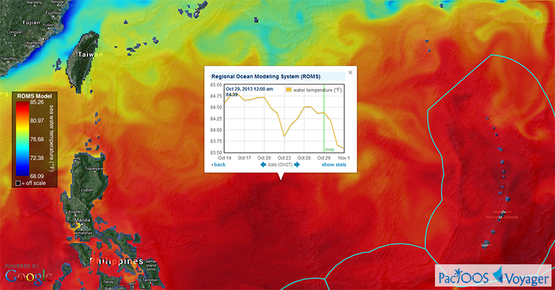
Voyager screenshot of ROMS CNMI water temperature near the ocean surface (click here for larger image):
Voyager screenshot of ROMS Guam currents near the ocean surface (click here for larger image):

These model results were generated as part of an academic research project. They provide a scientific prediction of current and future conditions. As with any forecast, however, accuracy cannot be guaranteed and caution is advised. While considerable effort has been made to implement all data components in a thorough, correct, and accurate manner, numerous sources of error are possible.


