Voyager Provides Several New Map Styles
Voyager Provides Several New Map Styles
Posted January 10, 2014Version 3 of the Google Maps API introduced the ability to apply custom map styles. Voyager now leverages this feature to provide a suite of alternative map styles, which can be accessed by clicking on the “More…” button near the upper-right corner of the map. Many of these new styles simplify or tone down Google’s basemap in order to help highlight and bring focus to Voyager’s raison d’être: its plethora of data overlays. For example, when viewing a wind forecast, it is easier to see the color-coded arrow icons (vectors) when the basemap has fewer distractions: no labels, roads, boundaries, or polygons and either a black-and-white or grayscale color scheme.
Some of the new map styles were pulled directly from a free online repository at Snazzy Maps while others were generated with the assistance of an interactive Styled Maps Wizard. If there are other styles you would like to see added to the site, please contact us.
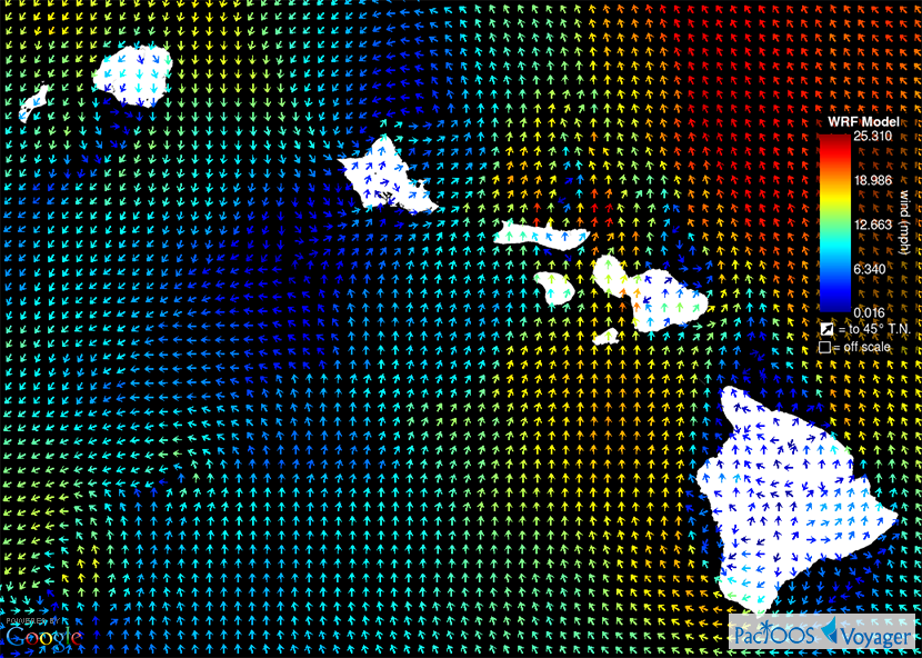
Voyager screenshot of Hawaiʻi WRF wind forecast with a simple black-and-white basemap (click here for larger image):
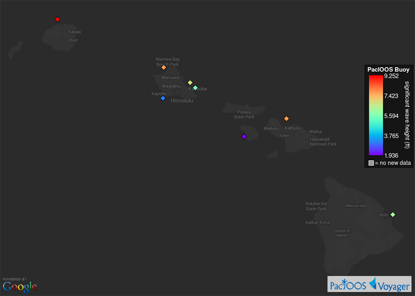
Voyager screenshot of PacIOOS wave buoys around Hawaiʻi with a dark grayscale basemap (click here for larger image):
Voyager screenshot of PacIOOS regions (blue EEZs) and global water level stations with a labeled gray-and-white basemap (click here for larger image):

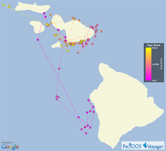
Voyager screenshot of tagged tiger shark 133362’s path of motion over a simple blue-and-beige basemap (click here for larger image):