

Voyager Overlays Now Searchable
Voyager Overlays Now Searchable
Posted May 30, 2014With hundreds of possible overlays now available through PacIOOS Voyager, having a search capability is frequently requested and long overdue. We are proud to announce a new search box above the list of data overlays on the left-hand side of the map. As you begin typing in a search phrase, a list of matching keywords appears below the search box and continues updating as you type. When you select one of the available keywords, the list of overlays is then filtered accordingly: only those overlays that support your search term will appear in the menu list. You can then expand the resulting categories or folders (e.g. hazards, waves, navigation) to reveal the matching overlays that each contains. To return to the full list of overlays, simply press the close button beside the search box to clear your search.
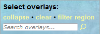
The new overlay search box (near upper left-hand corner of Voyager):
Searching for temperature data: (a.) keyword list; (b.) map categories containing overlays for “sea surface temperature (SST)”:
| a.) | 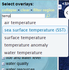 |
b.) | 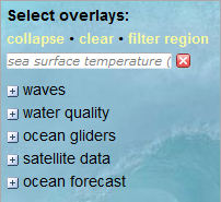 |
Searching for wave data: (a.) keyword list; (b.) map categories containing overlays for “significant wave height”:
| a.) | 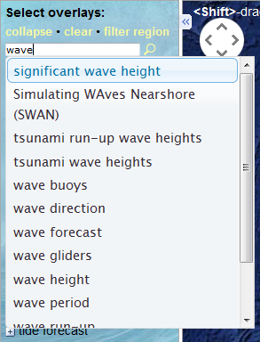 |
b.) | 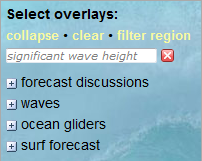 |
Searching for FAD buoys: (a.) keyword list; (b.) matching overlay for “fish aggregation devices (FAD)”:
| a.) | 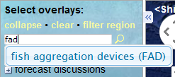 |
b.) |  |
Searching for tsunami-related information: (a.) keyword list; (b.) matching overlays for “tsunami”:
| a.) | 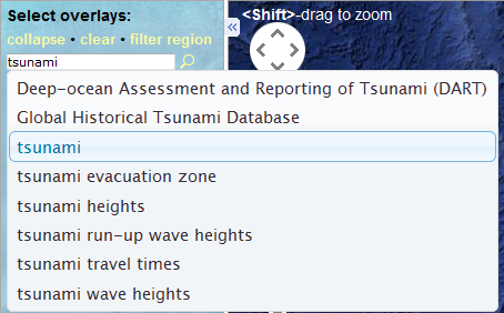 |
b.) |  |
Furthermore, the new overlay search tool works in conjunction with the existing “filter region” option (available above the search box). When you select a particular region to focus on (e.g. American Samoa, CNMI, FSM, Guam, Hawaiʻi, Palau, and/or RMI), a subset of overlays available for that region is shown. If you then also perform a keyword search, the list of overlays is further subset by that keyword within your region of interest. For instance, only showing overlays pertaining to sea surface temperatures (SST) in Guam.
So, what ocean data are you looking for? Waves, tides, whales, currents, temperatures, or… ? Let Voyager’s new search box help guide you on your next geospatial journey!


