Dataset Identifier:
hi_sohdop_all_three_nmi
Citation:
Citation Information:
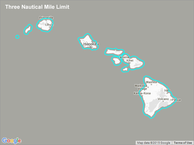
Title: Three Nautical Mile Limit - Hawaii
Originator: Hawaii Statewide GIS Program
Publication Date: January 25, 2016
Description:
Abstract:
The three nautical mile (3 nmi) limit refers to a traditional and now largely obsolete maritime boundary that defined a country's territorial waters, for the purposes of trade regulation and exclusivity, as extending as far as the reach of cannons fired from land. In its place, the Territorial Sea boundary at 12 nmi was established as the international norm by the 1982 United Nations Convention on the Law of the Sea.
Purpose: PacIOOS provides timely, reliable, and accurate ocean information to support a safe, clean, productive ocean and resilient coastal zone in the U.S. Pacific Islands region.
Spatial Domain:
Bounding Coordinates:
West Bounding Coordinate: -160.59567°
East Bounding Coordinate: -154.75309°
North Bounding Coordinate: 22.28532°
South Bounding Coordinate: 18.85975°
Keywords:
Theme:
Theme Keyword Thesaurus: GCMD Science Keywords
Keyword: Earth Science Human Dimensions Boundaries
Keyword: Earth Science Human Dimensions Boundaries Political Divisions Country Boundaries
Place:
Place Keyword Thesaurus: GCMD Location Keywords
Place Keyword: Continent North America United States Of America Hawaii
Place Keyword: Ocean Pacific Ocean Central Pacific Ocean Hawaiian Islands
Access Constraints:
None
Use Constraints:
Use Limitation: The data may be used and redistributed for free but is not intended for legal use, since it may contain inaccuracies. Neither the data Contributor, University of Hawaii, PacIOOS, NOAA, State of Hawaii nor the United States Government, nor any of their employees or contractors, makes any warranty, express or implied, including warranties of merchantability and fitness for a particular purpose, or assumes any legal liability for the accuracy, completeness, or usefulness, of this information.
Point of Contact:
Contact Information:
Contact Organization Primary:
Contact Organization: Hawaii Statewide GIS Program
Contact Electronic Mail Address: gis@hawaii.gov
Data Set Credit:
The Pacific Islands Ocean Observing System (PacIOOS) is funded through the National Oceanic and Atmospheric Administration (NOAA) as a Regional Association within the U.S. Integrated Ocean Observing System (IOOS). PacIOOS is coordinated by the University of Hawaii School of Ocean and Earth Science and Technology (SOEST).
Browse Graphic:
View full image
Browse Graphic File Name: http://www.pacioos.hawaii.edu/metadata/browse/hi_sohdop_all_three_nmi.png
Browse Graphic File Description:
Sample image.
Browse Graphic File Type: PNG
Back to Top
