

Providing Critical Coastal and Ocean Data to Pacific Islands Amidst Global Pandemic
Providing Critical Coastal and Ocean Data to Pacific Islands Amidst Global Pandemic
Posted April 22, 2020Hawaiʻi and other Pacific Islands highly depend on the delivery of goods transported by sea. In light of the ongoing COVID-19 pandemic, it is critical to keep marine transportation, port navigation, and other coastal activities safe and efficient to support island communities.
The Pacific Islands Ocean Observing System (PacIOOS), based at the University of Hawaiʻi at Mānoa’s School of Ocean and Earth Science and Technology (SOEST), collects and provides coastal and ocean observations that directly inform decision-making for safe ocean practices.
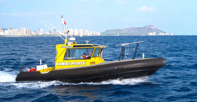
Captain Tom Heberle, President of the Hawaiʻi Pilots Association said, “Hawaiʻi’s state licensed port pilots are responsible for safely maneuvering large vessels such as container ships and oil tankers in and out of our commercial harbors. Real-time environmental data from PacIOOS such as wave height, current and wind speed readings provides us with the information needed to help ensure smooth delivery of essential consumer goods to Hawaiʻi’s residents.”

The delivery of goods transported by sea in Hawaiʻi. Credit: Capt. Ed Enos.
PacIOOS maintains an array of coastal and ocean observing assets throughout the Pacific Islands to collect data, including real-time information on waves, sea surface currents, ocean temperature, and wind. PacIOOS also generates high-resolution forecasts of wave run-up and inundation, wave and atmospheric conditions, and currents.
“We believe coastal and ocean information helps save lives and protects livelihoods and resources, and our team is doing everything we can to safely and responsibly fulfill our vision and mission during these uncertain times. We are committed to serving our partners and stakeholders across the region with reliable coastal and ocean observations and forecasts,” said Melissa Iwamoto, Director of PacIOOS.
All of PacIOOS’ data are freely available to the public at pacioos.org. Commercial and recreational ocean users, such as fishermen, shipping companies, boaters, and surfers, as well as agencies such as NOAA’s National Weather Service and the U.S. Coast Guard, rely on this type of information.
PacIOOS is one of 11 regional associations within a national network, the U.S. Integrated Ocean Observing System.


