Sea Level Rise : West Maui Wave-Driven Flooding With Sea Level Rise
An Interactive Mapping Tool for use with the State of Hawaiʻi Sea Level Rise Viewer
NOTE: This interactive mapping application is ill-suited for small screen sizes. Below is a screenshot only. Please visit again from a laptop or desktop computer to enable the application or make your browser window bigger.
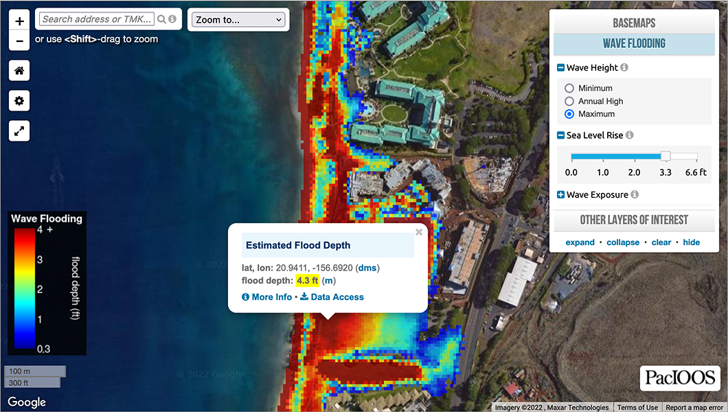
This interactive tool was created by adopting a next-generation modeling approach to build on and augment the wave flooding tool represented in the State of Hawaiʻi Sea Level Rise Viewer. The Details tab provides descriptions of the important aspects used to create this forecast. For a related forecast of real-time wave impacts in West Maui, please visit the PacIOOS West Maui Wave Run-Up Forecast.
Disclaimer
DISCLAIMER: This tool provides a scientific prediction of existing and potential future conditions from wave flooding*. The methodology is based on published, peer-reviewed techniques. However, as with any forecast, accuracy cannot be guaranteed and actual impacts may vary from these predictions. While considerable effort has been made to implement all components in a thorough, correct, and accurate manner, errors are still possible. The results are provided without warranty of any kind. The risks associated with use or non-use of the results are assumed by the user.
*NOTE: This information can be used in conjunction with the Sea Level Rise Exposure Area (SLR-XA) in the State of Hawaiʻi Sea Level Rise Viewer; however, it does not replace the SLR-XA for planning or mandatory seller real estate disclosures effective May 1, 2022 by Act 179.
Wave Flooding Layer
Wave Flooding Layer
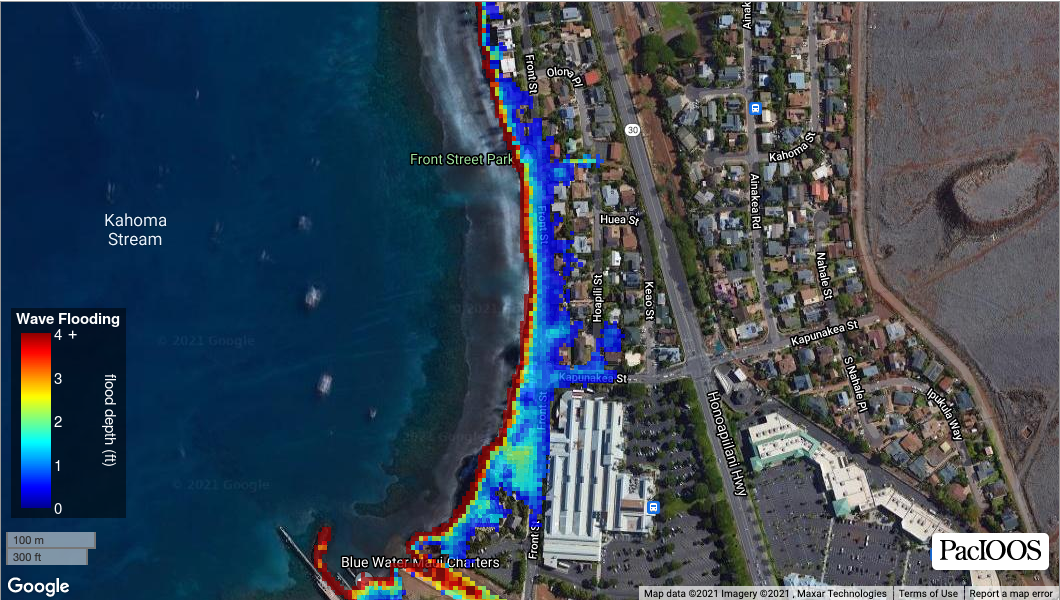
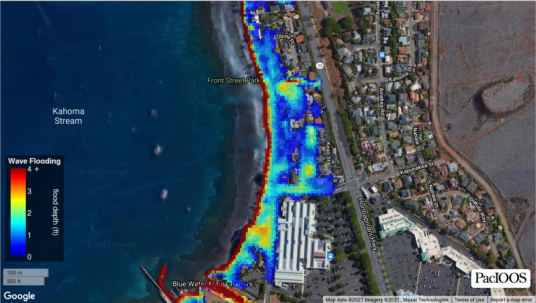

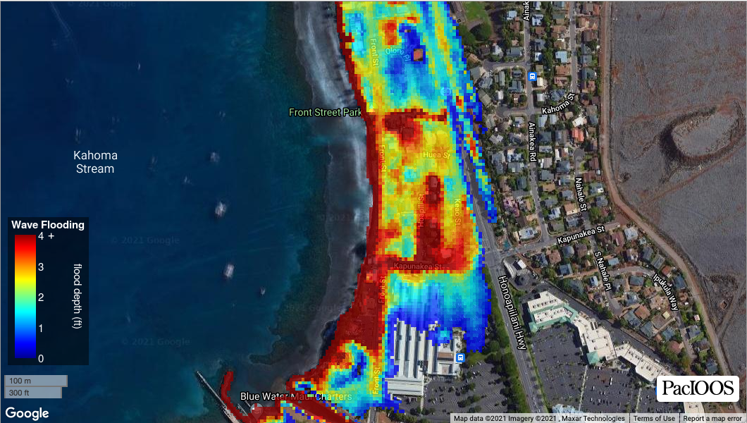
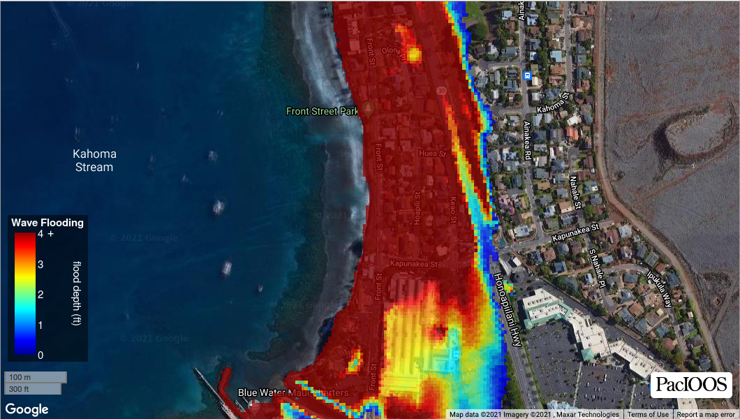
Data source: PacIOOS
A new modeling approach was implemented here to simulate wave-induced coastal inundation. Using the Boussinesq Ocean and Surf Zone (BOSZ) phase-resolving model (Roeber and Cheung, 2012), we produced simulations of inundation depth over land for selected combinations of swell amplitudes and directions under different water levels (WLs) that are controlled by the astronomical tides, long-period anomalies (hereafter, referred to as: background WL), and long-term sea level rise (SLR). The simulations represent three scenarios:
- Minimum Wave Flooding (minimal swell and high background WL);
- Annual High Wave Flooding (large swell and high background WL), and;
- Maximum Wave Flooding (largest swell and highest background WL).
Simulations for the above three scenarios are repeated for the following SLR projections: 0.0 m; 0.3 m (1 ft); 0.6 m (2 ft); 1.0 m (3.3 ft), and; 2.0 m (6.6 ft). Modeling was carried out over a high-resolution two-dimensional digital elevation model (DEM) that was created by blending the following DEM grids: lidar data from a 2013 survey by the U.S. Army Corps of Engineers (USACE) (cloud data with resolution on the order of meters), plus lidar data from a 2000 survey by USACE (cloud data with resolution on the order of meters; used only to fill certain data gaps found in the 2013 lidar survey), and; multibeam bathymetry data from the Hawaii Mapping Research Group (HMRG) (50-m resolution) (Smith et al., 2011). Results include 50 possible scenarios, gridded at 5-m resolution and spanning the coastline of West Maui, Hawaii.
For further details, please see the Details tab.
Data access: ERDDAP, THREDDS, NetCDF, OPeNDAP, WMS, metadata
Suggested data citation: Azouri, A., M. Guiles, and D.S. Luther. 2022. BOSZ Wave-Driven Sea Level Rise Inundation: West Maui. Distributed by the Pacific Islands Ocean Observing System (PacIOOS). http://pacioos.org/metadata/bosz_westmaui.html. Accessed [date].
Other Layers Of Interest
Moku Boundaries

Data source: Office of Hawaiian Affairs and Hawaiʻi Office of Planning Statewide GIS Data Program
Historic land divisions. Each island, or mokupuni, is divided into large districts, or moku. These are then further divided into ahupuaʻa (see below). Created by the Office of Hawaiian Affairs. Although not survey grade, and not checked for legal validity, the boundaries correspond to 19th-century survey maps. The orthography of each name was researched, including spelling and diacritical marks. Traditional moku boundaries extended into the ocean. However, this seaward extension is not depicted by this layer.
Data access: Shapefile , ArcGIS REST (layer: “Moku”), WMS (layer: “2”), WFS, metadata
Suggested data citation: Office of Hawaiian Affairs and Hawaiʻi Statewide GIS Program. Moku Boundaries (Historic Land Divisions). https://planning.hawaii.gov/gis/download-gis-data-expanded/. Accessed [date].
Ahupuaʻa Boundaries
Data source: Office of Hawaiian Affairs and Hawaiʻi Office of Planning Statewide GIS Data Program
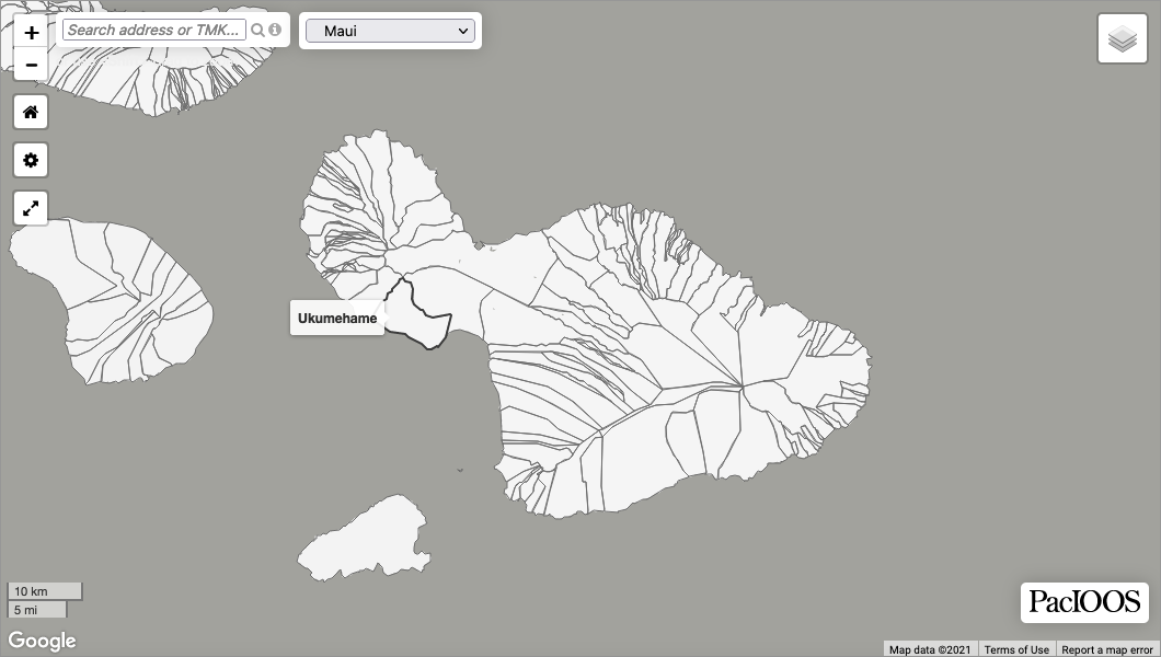
Historic land divisions. Each island, or mokupuni, is divided into large districts, or moku (see above). These are then further divided into ahupuaʻa, usually extending from the uplands to the sea. Created by the Office of Hawaiian Affairs. Although not survey grade, and not checked for legal validity, the boundaries correspond to 19th-century survey maps. The orthography of each name was researched, including spelling and diacritical marks. Traditional ahupuaʻa boundaries extended into the ocean. However, this seaward extension is not depicted by this layer.
Data access: Shapefile , ArcGIS REST (layer: “Ahupuaa”), WMS (layer: “1”), WFS, metadata
Suggested data citation: Office of Hawaiian Affairs and Hawaiʻi Statewide GIS Program. Ahupuaʻa Boundaries (Historic Land Divisions). https://planning.hawaii.gov/gis/download-gis-data-expanded/. Accessed [date].
Flood Hazard Zones
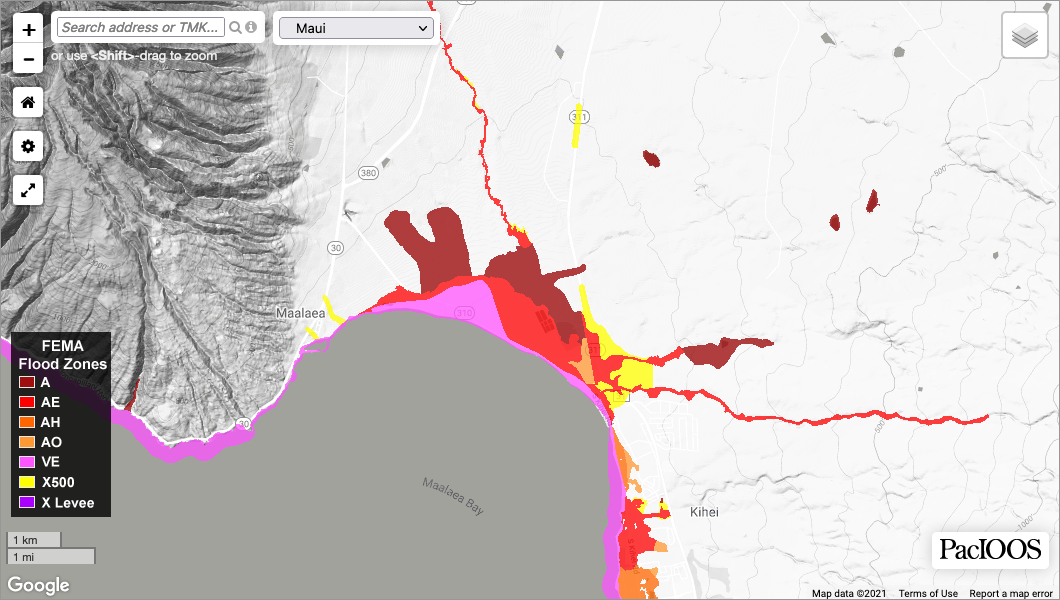
Data source: Federal Emergency Management Agency (FEMA) and Hawaiʻi Office of Planning Statewide GIS Data Program
Flood hazard zones for the State of Hawaiʻi are established by the U.S. Federal Emergency Management Agency (FEMA) through the Flood Insurance Rate Maps (DFIRM). Areas that fall within the 100-year flood boundary (a.k.a. base flood or floodplain) are called Special Flood Hazard Areas (SFHA) and are divided into insurance risk zones A, AE, AH, AO, or VE. The term 100-year flood indicates that the area has a 1% chance of flooding in any given year. Zones X500 and X Levee are Non-Special Flood Hazard Areas (NSFHA) and have moderate-to-low flood risk. The FIRMS are used by the National Flood Insurance Program (NFIP) for floodplain management, mitigation, and insurance purposes. The FIRMs are based on hydraulic modeling of present day flood risk and do not include future increases in flood hazards with sea level rise. See also: State of Hawaiʻi, Department of Land and Natural Resources (DLNR), Flood Hazard Assessment Tool (FHAT).
Data access: Shapefile , ArcGIS REST (layer: “State DFIRM”), WMS (layer: “2”), WFS, metadata
Suggested data citation: Federal Emergency Management Agency and Hawaiʻi Statewide GIS Program. Flood Hazard Zones. https://planning.hawaii.gov/gis/download-gis-data-expanded/. Accessed [date].
Beach and Sand (USDA)
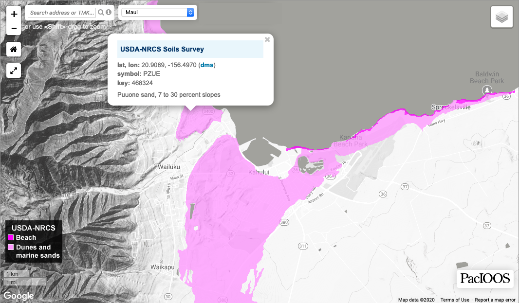
Data source: U.S. Department of Agriculture (USDA) Natural Resources Conservation Service (NRCS) and Hawaiʻi Office of Planning Statewide GIS Data Program
The beach and sand map layer serves as a useful guide to understanding the physical setting of coastal areas around the State and how these areas may be affected by increased flooding and erosion with sea level rise. This layer is adapted from the Gridded USDA-NRCS Soil Survey Geographic (gSSURGO) database. For the purposes of this website, we have highlighted beaches and sand, including dunes and other areas with sandy substrates. These areas may be more susceptible to coastal erosion. However, it should be noted that beach environments may be sustained if they are allowed to migrate landward and erode into upland deposits of beach and dune sand, releasing this sediment into the littoral system. The Beach and Sand layer identifies surficial deposits only. It should be used as an initial screening tool and may require verification at the site level.
Data access: Shapefile , ArcGIS REST (layer: “Soils (Areas) – NRCS”), WMS (layer: “4”), WFS, metadata
Suggested data citation: U.S. Department of Agriculture, Natural Resources Conservation Service. 2016. Gridded Soil Survey Geographic (gSSURGO) Database. https://geoportal.hawaii.gov/datasets/soils-mu-state-of-hawaii. Accessed [date].
Geology (USGS)
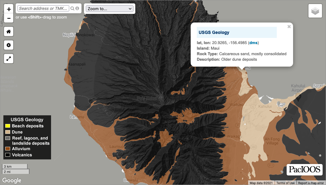
Data source: U.S. Geological Survey Geologic Map of the State of Hawaiʻi (Sherrod, et al. 2007)
The geology map layer serves as a useful guide to understanding the physical setting of coastal areas around the State and how these areas may be affected by increased flooding and erosion with sea level rise. For the purposes of this website, we have categorized the geology into beach and dune deposits, marine and lagoon deposits, alluvium deposits, and volcanic deposits. Volcanic and marine limestone deposits may be more resistant to coastal erosion. In contrast, deposits of sand and alluvium may be more susceptible to coastal erosion. However, it should be noted that beach environments may be sustained if they are allowed to migrate landward and erode into upland deposits of beach and dune sand, releasing this sediment into the littoral system. The Geology layer identifies surficial deposits only. It should be used as an initial screening tool and may require verification at the site level.
Data access: Shapefile , GeoJSON, WMS-C (layer: “hi_usgs_all_geology”), WMS, WFS, KML, metadata
Suggested data citation: Sherrod, David R., Sinton, John M., Watkins, Sarah E., and Brunt, Kelly M. 2007. Geologic map of the State of Hawaiʻi: U.S. Geological Survey Open-File Report 2007-1089. http://pubs.usgs.gov/of/2007/1089/. Accessed [date].
State Land Use Districts
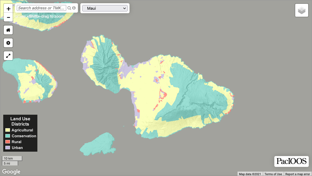
Data source: Hawaiʻi Office of Planning Statewide GIS Data Program
Pursuant to Hawaiʻi Revised Statutes §205, all lands in the State of Hawaiʻi are classified and placed into four land use districts: Urban, Rural, Agricultural, and Conservation. This land use district map layer serves as a useful guide in determining potential impacts of sea level rise to the various land use classifications within a community. The boundaries depicted here are not official and for presentation purposes only. A determination of the official State Land Use District Boundaries should be obtained directly through the State Land Use Commission (LUC).
Data access: Shapefile , ArcGIS REST (layer: “State Land Use Districts”), WMS (layer: “23”), WFS, metadata
Suggested data citation: State of Hawaiʻi Land Use Commission and Hawaiʻi Statewide GIS Program. State Land Use Districts. https://planning.hawaii.gov/gis/download-gis-data-expanded/. Accessed [date].
TMK Parcels
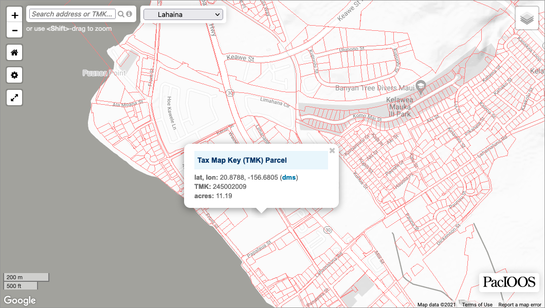
Data source: Hawaiʻi Office of Planning Statewide GIS Data Program
Tax Map Key (TMK) parcel boundaries for the State of Hawaiʻi.
CAUTION: Misalignment between the TMK parcel boundaries and basemap layers may be visible in some areas. Parcel boundaries from the Hawaiʻi Office of Planning Statewide GIS Data Program were not derived from metes and bounds and are not survey grade data. Users may utilize the satellite imagery basemap along with the TMK parcels to determine if a property is exposed to inundation hazards.
All property lots in Hawaiʻi are defined by a 9-digit TMK number using the following format, without any special characters (e.g., 392118043):
C-Z-S-PPP-ppp
- C = county number (1 digit)
- Z = zone number (1 digit)
- S = section number (1 digit)
- PPP = plat number (3 digits)
- ppp = parcel number (3 digits)
County numbers include the following:
- 1 = City and County of Honolulu
- 2 = Maui County
- 3 = Hawaiʻi County
- 4 = Kauaʻi County
Data access: Shapefile , ArcGIS REST (layer: “Statewide TMKs”), WMS (layer: “1”), WFS, metadata
Suggested data citation: Hawaiʻi Statewide GIS Program. TMK Parcels. https://planning.hawaii.gov/gis/download-gis-data-expanded/. Accessed [date].
Suggested Citation
Suggested citation: Pacific Islands Ocean Observing System (PacIOOS). 2022. West Maui Wave-Driven Flooding With Sea Level Rise. Version 1.05. http://pacioos.org/shoreline/slr-westmaui/. Accessed [date].
NOTE: Additionally, please cite any other data sources used as suggested in the layer descriptions above.
Update History
Publication Date: August 10, 2022
Last Updated: May 28, 2024
Version: 1.05
Update History:
This Wave Flooding Tool was developed by the Pacific Islands Ocean Observing System (PacIOOS) at the University of Hawaiʻi at Mānoa (UH) School of Ocean and Earth Science and Technology (SOEST) through a collaborative effort led by the Coastal Hazards Group in the Department of Oceanography at UH, and funded by the National Oceanic and Atmospheric Administration (NOAA) grant “Enhanced Community Resilience With Real-Time Notifications of Hazardous Wave-Driven Flooding and Erosion Events” (award #NA17NOS4730143). The PacIOOS Wave Run-Up Forecast for West Maui was also developed with support from this grant.
Contact
Please contact us at info@pacioos.org if you have any questions.
1. Synopsis
2. Scenarios
3. Estimating the Wave and Water Level Characteristics for Each Scenario
4. Model Setup
4.1. Digital Elevation Model (DEM)
4.2. Boundary Conditions at the Wavemakers
4.3. Preparing the Wave Inputs for the Wavemakers
5. Flooding Depth – The Wave Flooding Tool’s Principal Modeled Product
6. Assumptions and Limitations
References
Footnotes
1. Synopsis
This interactive West Maui Wave Flooding Tool (hereafter, referred to as: Wave Flooding Tool) was created by adopting a next-generation modeling approach to build on and augment the annual high wave flooding model represented in the State of Hawaiʻi Sea Level Rise Viewer (Viewer).
Wave propagation and evolution near the shore have been modeled to map the resulting coastal flooding along West Maui for selected combinations of wave amplitudes and directions, given a variety of water levels (WLs). The WL comprises the astronomical tides (WLtide), the slowly-oscillating ocean sea level height around Maui (WLanom; e.g., due to El Niño), and long-term sea level rise (WLslr). The flooding patterns were calculated for two representative wave directions from the north and two from the south. The appropriate wave amplitudes were determined from statistical analyses of historical records of significant wave height (Hs) observed at local wave buoys. The background WL due to WLtide and WLanom used is called the Mean Higher High Water (MHHW); it was determined from statistical analyses of historical records of WL from a nearby tide gauge. The sea level rise (SLR) contribution to WL (WLslr) is based on the SLR projections of the RCP8.5 scenario, the 5th Assessment Report (AR5) of the Intergovernmental Panel on Climate Change (IPCC, 2014).
Similar to the modeling approach validated and adopted for the West Maui Wave Run-Up Forecast, the phase-resolving numerical model called Boussinesq Ocean and Surf Zone (BOSZ; Roeber and Cheung, 2012) was employed on a high-resolution horizontal grid. The computations were accomplished in two separate but overlapping rectangular domains with grid cell dimensions of 16.5 ft × 16.5 ft (5 m × 5 m).
2. Scenarios
The modeling effort focused on three scenarios of wave and water level (WL), as illustrated in Figure 1. The Mean Higher High Water (MHHW) background WL for scenarios 1 and 2, which includes tides and open ocean sea level anomalies, were estimated from 18.6-year-long sea level records. This particular record length is needed to account for the full cycle of the moon’s declination variation, which directly affects the tidal amplitude in the WL. The WL in scenario 3 is taken as the highest contribution from tides and long-period anomalies from the same records.
The three modeled scenarios are as follows (see corresponding Figures 1.a-1.c):
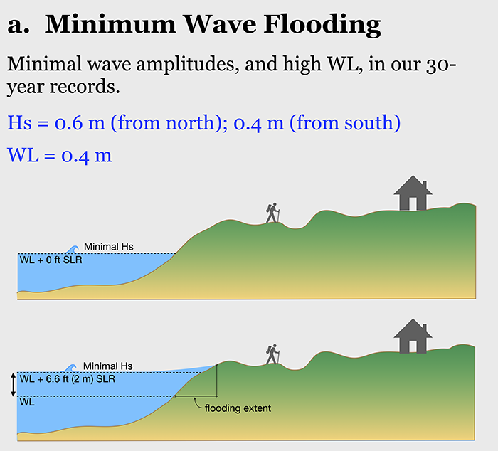
- Minimum Wave Flooding (Minimal Swell and High Background WL). Consists of minimal wave amplitudes and high WL (WLtide + WLanom). The WL is the calculated MHHW (based on observations covering the 18.6 year period from May 2002 to December 2020).
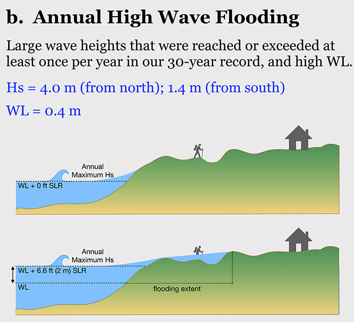
- Annual High Wave Flooding (Largest Annually-Recurring Waves, and High Background WL). The wave heights were reached or exceeded at least once in each of the 30 years analyzed (from 1990 to 2020). The WL is the calculated MHHW (based on observations covering the 18.6 year period from May 2002 to December 2020).
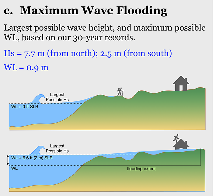
- Maximum Wave Flooding (Largest Swell and Highest Background WL). This is the estimated maximum possible event consisting of the largest observed Hs, maximum WLtides, and maximum WLanom, occurring in 30 years of respective data. Although these wave height and water level values have occurred within our 30-year-long Hs and WL records, the likelihood for them to coincide at one point in time is low; nevertheless, it represents an extreme scenario that could occur at some point in the future, and therefore has value for the risk averse.
Numerical model simulations of the above three scenarios were repeated for four wave directions, two directions from the north and two directions from the south, along with the following SLR projections: 0.0 ft; 1 ft (0.3 m); 2 ft (0.6 m); 3.3 ft (1.0 m); and, 6.6 ft (2.0 m).
Figure 1a. (Click on image for larger view.) Illustration of the Minimum Wave Flooding scenario. Similar to a static fill model yet including minimal wave amplitudes, and a background water level (WL), or Mean Higher High Water (MHHW) (tides plus open ocean sea level anomalies), calculated from our WL records. The bottom image in this figure illustrates the highest sea level rise (SLR) that we consider (SLR = 6.6 ft), plus the wave-driven flooding extent.
Figure 1b. (Click on image for larger view.) Illustration of the Annual High Wave Flooding scenario. Used as input parameters are high wave amplitudes that have occurred at least once per year in our 30-year wave records, and a background water level (WL), or Mean Higher High Water (MHHW) (tides plus open ocean sea level anomalies), calculated from our WL records. The bottom image in this figure illustrates the highest sea level rise (SLR) that we consider (SLR = 6.6 ft), plus the wave-driven flooding extent.
Figure 1c. (Click on image for larger view.) Illustration of the Maximum Wave Flooding scenario. Used as input parameters are the highest wave amplitude in our 30-year wave records, and the highest water level (WL) due to tides and open ocean sea level anomalies that were found in our 30-year WL records. The bottom image in this figure illustrates the highest sea level rise (SLR) that we consider (SLR = 6.6 ft), plus the wave-driven flooding extent.
3. Estimating the Wave and Water Level Characteristics for Each Scenario
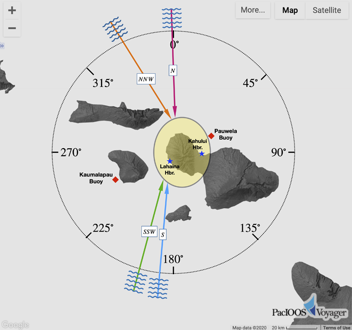
Thirty-year-long records (years 1990-2020) of significant wave height (Hs) from nearby wave buoys, and water level (WLs) from a nearby tide gauge, were used to determine the wave heights and WLs, respectively, that are associated with the three scenarios. The wave buoys are: Pauwela, Maui (CDIP187), Waimea Bay, Oʻahu (CDIP106), or Northwestern Hawaiʻi (NDBC 51001) for northerly wave events, and Kaumalapau, Lānaʻi (CDIP146 or CDIP239) or Southwest Hawaiʻi (NDBC 51002) for southerly wave events (Figure 2). The sea level (tide) gauge is located in Kahului Harbor (NOAA/NOS/CO-OPS 1615680) (Figure 2). The wave amplitudes found for each scenario at each buoy required a transfer function (to account for refraction, shoaling, and dissipation) in order to be employed as input to the BOSZ coastal wave model. The long-duration Kahului Harbor dataset was determined to be appropriate for the West Maui region, given the high correlation of long-period sea level variability between Lahaina Harbor (which is in the middle of the West Maui region), and Kahului Harbor (Figure 2). The Lahaina Harbor record itself covered an insufficient number of years to create robust WL statistics.
Figure 2. (Click on image for larger view.) The four wave directions that were used in the modeling effort. The locations of Kahului and Lahaina harbors are indicated with the blue star symbols, and the locations of Pauwela and Kaumalapau wave buoys are indicated with red rhombus symbols.
The chosen wave directions were dictated by the geometry of the islands in the Maui Island group. The window of wave approach to West Maui is blocked by Molokaʻi, Lānaʻi, and Kahoʻolawe islands. Therefore, wave energy that reaches West Maui must approach through narrow directional windows. From the north, the largest wave events originate from northern hemisphere wintertime storms, and are within the directional window of northwest to north (Vitousek, 2007; see Figures 24 and 27). However, shadowing from Molokaʻi Island permits waves to reach West Maui without obstruction from a narrow northerly cone (see Figure 4-8, section 4.1.7.1 in DLNR, 2013). Therefore, two representative northerly wave directions—north-northwest and north—were modeled (Figure 2).
From the south, the largest wave events originate from southern hemisphere wintertime storms or hurricanes passing the islands to the south (summer season in Hawaiʻi), and the narrow directional window for West Maui is south to south-southwest (see Figure 22 in the Hawaiʻi Sea Level Rise Vulnerability and Adaptation Report). Therefore, two representative southerly wave directions—south and south-southwest—were modeled (Figure 2).
Very few swell events impact the Hawaiian archipelago from the west. Those few events in the multi-decade records analyzed are due to hurricanes passing south of the island and then turning north. For the coast of West Maui, waves arriving from the west (not associated with hurricane activity) are due to north swell refracting around Molokaʻi and transiting the Lānaʻi-Molokaʻi channel. The high resolution SWAN model that is utilized for surf zone model input accounts for this refraction.
It is important to note that this Wave Flooding Tool does not explicitly incorporate all the phenomena that create sea level rise and flooding during landfall of a hurricane, such as reduced air pressure and onshore winds.
4. Model Setup
Important information required before the model calculations could begin is the following: (i) a digital elevation model (DEM), and; (ii) the specific wave forcing, as a function of position, along the model domain boundaries. In addition, the bottom friction is modeled using separate bed roughness coefficients for the ocean and land.
4.1. Digital Elevation Model (DEM)
The DEM used were a blend of several products having different grid resolutions. Together, these cover both nearshore topography and bathymetry (i.e., underwater topography). The datasets blended into the DEM of this modeling effort are:
- Bathymetry and topography from a 2013 Lidar survey conducted by the Army Corps of Engineers (USACE 49750). This dataset provides good values on a 3.3 ft (1 m) horizontal grid down to 82 ft (25 m) depth. Nearly the entire coastline of West Maui is covered by this dataset, but for the few locations where it is not covered, the land data from an older Lidar survey conducted in 2000 by USACE was used (also known as SHOALS; USACE 49740). This older dataset was gridded to 33 ft (10 m) resolution horizontally.
- Bathymetry from a multibeam survey at 164 ft (50 m) resolution for the offshore region. This dataset was obtained from the Hawaiʻi Mapping Research Group (HMRG; hmrg_bathy_50m_mhi).
The above datasets were merged and the resulting dataset was then gridded to a fixed resolution of 16.5 ft × 16.5 ft (5 m × 5 m).
4.2. Boundary Conditions at the Wavemakers
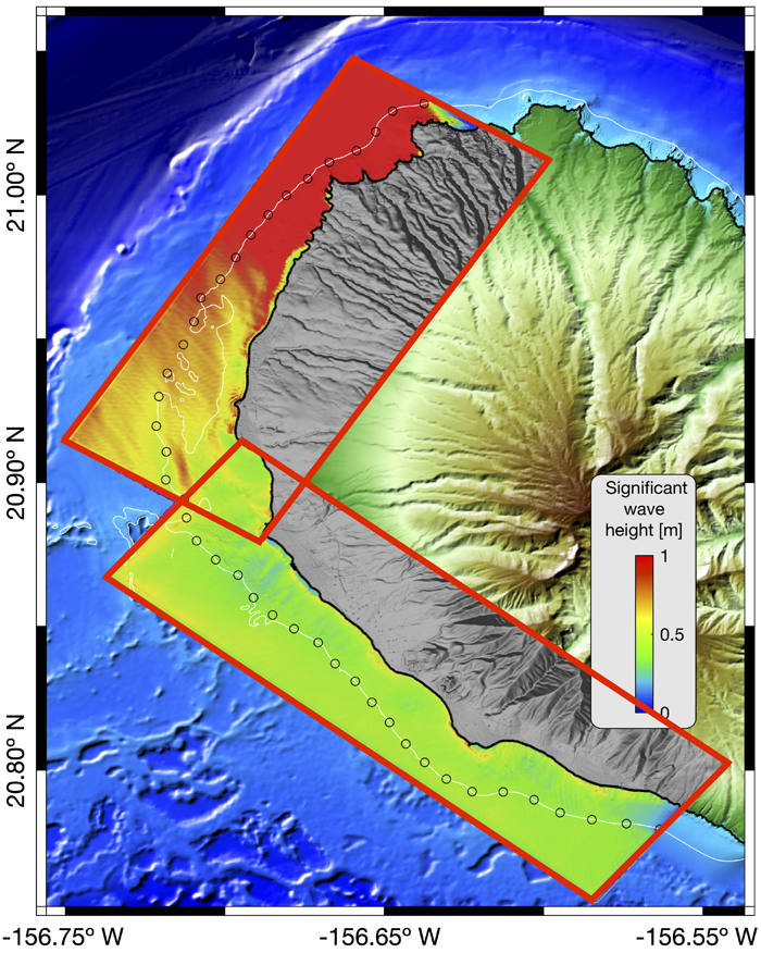
The flooding simulations were accomplished within two rectangular domains that overlap around the middle of West Maui’s coastline, as shown in Figure 3. The northerly computational domain (hereafter, referred to as domain 1) is oriented at 301° (clockwise from north), and it extends 11 mi (17.7 km) in the alongshore direction and 4.8 mi (7.7 km) in the cross-shore direction. The southerly computational domain (domain 2) is oriented at 222° (clockwise from north), and it extends 13.2 mi (21.2 km) in the alongshore direction and 4.5 mi (7.3 km) in the cross-shore direction.
Figure 3. (Click on image for larger view.) The setup of two rectangular computational domains that were used for the BOSZ simulations. The 42 circles along the 40 m depth contour are the virtual gauge sites where the wave field from SWAN is provided as input to BOSZ. The particular significant wave heights shown are for a wave event from the north.
The model was forced by activating each domain’s wavemakers at their offshore and two lateral boundaries (hereafter, called: offshore and lateral wavemakers, respectively). Wave inputs were provided along the offshore wavemaker at 42 equidistant virtual gauge sites (VGSs) along the 131 ft (40 m) depth contour (indicated as circles in Figure 3). The northernmost 20 VGSs were used to provide inputs to domain 1, and the southernmost 24 VGSs were used to provide inputs to domain 2. In each computational domain, input from the closest VGS was used to derive the lateral wavemakers. The following subsection describes how the datasets that serve as wavemaker inputs at the VGSs were obtained.
4.3. Preparing the Wave Inputs for the Wavemakers
Multiple wave inputs along the wavemakers, as opposed to a single input as is often used in hydrodynamic wave models, account for variations of the wave field along the domain’s boundaries, greatly improving the model’s nearshore accuracy1. The relationships between these spatially-dependent wave inputs and the wave scenarios at the two wave buoys needed to be determined. This was accomplished as follows:
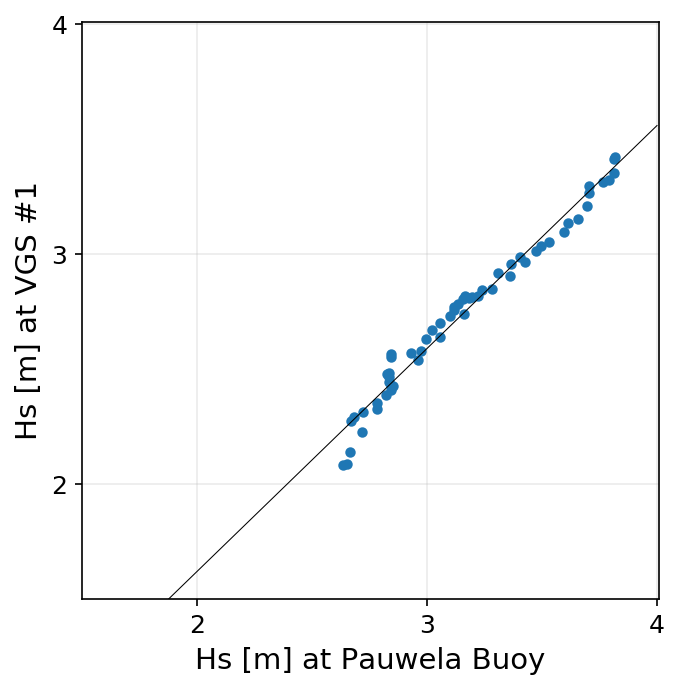
- Archived significant wave height (Hs) output from an operational high-resolution regional Maui County Simulating WAves Nearshore (SWAN) model (swan_maui) was sub-sampled at the 42 VGSs and at the nearby buoy locations. Plots were created of the Hs at the VGSs against Hs at each buoy location for each of the wave directions. An example of this step is illustrated in Figure 4.
- A straight line was fit to the scattered data for each VGS. This line fit corresponded to a particular wave direction, and it allowed us to determine Hs at the VGSs given Hs at a buoy site.
Figure 4. (Click on image for larger view.) Scatter of significant wave height (Hs) at virtual gauge site (VGS) #1 versus Hs at Pauwela wave buoy site, for an observed large northerly swell. The black line passing through the data is the corresponding straight line fit.
5. Flooding Depth – The Wave Flooding Tool’s Principal Modeled Product
Each simulation for a Minimum Wave Flooding scenario was run for 45 minutes, while the simulations for the Annual High Wave Flooding and Maximum Wave Flooding scenarios were run for 140 minutes. The longer simulation length of the latter two was needed to allow sufficient time for enough wave bores (swash) to roll over the land to create significant mean depth statistics.
The extent of flooding for each scenario was mapped from the flooded model grid cells (fully or partially wet) over land. At each of these mapped grid points, the mean of the five largest water depths throughout the entire simulation time was calculated. This quantity is reported as the flooding depth. This methodology of defining the flooding depth is consistent with the methodology used in the State of Hawaiʻi Sea Level Rise Viewer (Viewer).
In the Wave Flooding Tool, there are often areas of land that are away from the ocean but that are also flooded. Those sites are not high above sea level, and when the water level (WL) in some of the simulations is sufficiently high, water reached those sites and filled them, even under minimal levels of wave energy (i.e., the Minimum Wave Flooding scenario).
6. Assumptions and Limitations
The quality of the wave modeling work described above depended on the quality of the inputs provided. The most critical assumptions and limitations involved in this study are as follows:
- The wave parameters were determined from statistical analyses of 30-year-long historical data records; therefore, they do not account for potential changes in the wave climate (i.e., storm intensity and how frequently large storms will occur).
- The shoreline interface is a dynamic boundary between the ocean and land that can display significant changes between seasons, and even during single storm events. The same is true for the shape (e.g., length, width) of a beach. The digital elevation model (DEM) used represents a snapshot of the land surface at a particular time, which may not be representative of the shoreline and beach shape during the season of most severe wave impact along certain coastlines (e.g., north- versus south-facing coastlines).
- This DEM also does not include vegetation, shoreline structures, and buildings (i.e., it is a “bare earth” DEM), and the waves are assumed to travel over an impermeable surface.
References
- Booij, N., R.C. Ris, and L.H. Holthuijsen (1999). A third-generation wave model for coastal regions: 1. Model description and validation. Journal of Geophysical Research: Oceans, 104(C4), 7649-7666. https://doi.org/10.1029/98JC02622.
- Bretschneider, C.L., H.J. Krock, E. Nakazaki, and F.M. Casciano (1986). Roughness of typical Hawaiian terrain for tsunami run-up calculations: A user’s manual. JKK Look Laboratory Report, University of Hawaiʻi, 42.
- Cheung, K.F., Y. Bai, and Y. Yamazaki (2013). Surges around the Hawaiian Islands from the 2011 Tohoku tsunami. Journal of Geophysical Research: Oceans, 118(10), 5703-5719. https://doi.org/10.1002/jgrc.20413.
- DLNR (2013). Final Environmental Assessment for Permanent Shore Protection of the Hololani Resort Condominiums, Kahananui, Lahaina, Maui. Prepared by Sea Engineering, Inc. July 2013.
- IPCC (2014). Climate Change 2014: Synthesis Report. Contribution of Working Groups I, II and III to the Fifth Assessment Report of the Intergovernmental Panel on Climate Change [Core Writing Team, R.K. Pachauri and L.A. Meyer (eds.)]. IPCC, Geneva, Switzerland, 151 pp.
- Roeber, V. and J.D. Bricker (2015). Destructive tsunami-like wave generated by surf beat over a coral reef during Typhoon Haiyan. Nature communications, 6(1), 1-9. https://doi.org/10.1038/ncomms8854.
- Roeber, V. and K.F. Cheung (2012). Boussinesq-type model for energetic breaking waves in fringing reef environments. Coastal Engineering, 70, 1-20. https://doi.org/10.1016/j.coastaleng.2012.06.001.
- Vitousek, S. (2007). Nearshore hydrodynamics at Kaʻanapali, Maui; and Hawaiʻi extreme wave statistics. Master of Science Thesis. Department of Geology and Geophysics, University of Hawaiʻi at Mānoa, Honolulu, Hawaiʻi, USA. 60 pp.
Footnotes
- Figures 7 and 8 in the Details page of the West Maui Wave Run-Up Forecast illustrate the high level of agreement between the model’s outputs and observations at selected sites in the Kahana region.
The development of this forecast would not have been possible without the generous support from the West Maui community. We would like to thank our local partners for their continued in-kind support for this project, including accommodations at Sands of Kahana from Soleil Management (Wayne Cober and Gary Mano); boat support for instrument deployments from Ultimate Whale Watch (Peter and Toni Colombo, Lee James and Captain Amy Venema); field work staging support and accommodations from Donna Brown, Marine Options Coordinator and Lecturer, University of Hawaiʻi Maui College; and diving support from University of Hawaiʻi Maui College student Caroline Sabharwal. In addition, we also acknowledge the following divers: Gordon Walker, Christina Comfort, and Chip Young. Finally, Tara Owens and Volker Roeber also contributed to the data collection effort.


