Wave Observations : Ngaraard, Babeldaob, Palau
NOTE: Click on the plot below for data at a specific time.
NOTE: This instrument does not report in real-time. New data are retrieved periodically.
start date: : temperature: wave height: wind: rain: currents: site:
Disclaimer: Near real-time data have not been quality controlled.
Disclaimer: Data are released in compliance with real-time quality control standards.
Disclaimer: Real-time data are provided as raw and unaltered. Results of quality control checks are provided within the data set.
wave height:
Spectrum plots are unavailable for this buoy at this time. Please check back later.
Figure 1. The above figure shows the swell directional spectrum of the wave energy field, which is calculated from the wave buoy accelerometer and tilt sensor data over a 26-minute time span. This depicts the direction from which waves are propagating as a function of wave period (duration between wave crests) and wave energy. Wave direction is labeled around the circumference of the plot in compass degrees (0° = North, 90° = East, 180° = South, 270° = West). Wave period is labeled in red in seconds, with longer periods near the center of the plot and shorter periods towards the outer edge. In order to characterize the swell, this plot limits itself to wave periods greater than 8 seconds (see the full directional spectrum below to view short-period wind waves). Warmer colors on the figure represent higher levels of wave energy (bigger waves) while cooler colors indicate less wave energy (smaller waves). In this way, one can quickly see how waves have varied in size, speed, and direction at the buoy location. The corresponding significant wave height (Hs), peak wave period (Tp), and peak wave direction (Dp) are also listed.
Figure 2. The above figure shows the full directional spectrum of the wave energy field. While Figure 1 limits itself to swells with a wave period greater than 8 seconds, this figure also includes shorter period wind waves. Swell waves are produced by distant storm systems far offshore, producing higher period (longer wave length) waves. Waves generated by local winds have a much lower period (shorter wave length) and can serve as an indicator of how choppy the water is.
Figure 3. The above figure shows the temporal spectrum of the wave energy field for the past 72 hours. This depicts how both wave period and wave energy have changed over time, with longer periods near the top of the plot and shorter periods towards the bottom. As in Figure 1, warmer colors represent higher levels of wave energy (bigger waves) while cooler colors indicate less energetic waves (smaller waves). Unlike Figure 1, this plot does not indicate wave direction.
NOTE: Click on the plot below for data at a specific time.
: wave height:
This WaveWatch III (WW3) global wave model output shows forecasts of wave conditions associated with different wave components of the mixed sea state. The WW3 GFS-Wave spectral bulletin used to generate these plots was retrieved from NOAA/NCEP/NWS for buoy * (see "gfs.yyyymmdd/hh/wave/station/bulls.thhz/gfswave..bull"). The top panel shows significant wave heights, the middle panel illustrates the direction that peak waves are traveling from in degrees (0° = North, 90° = East, 180° = South, 270° = West, 360° = North), and the bottom panel plots peak wave periods in seconds. Each color indicates a different wave component (lettered A through F) from the forecasted wave spectrum, which typically arise due to differing storm or wind conditions. The dark blue curve in the top panel is the total, or bulk, significant wave height model forecast (i.e., the sum of all wave energy [not wave heights] for components A through F). The dark blue dots and curve for direction and period, respectively, represent those of the highest (top) peak of the wave spectra. The dark gray curve or dots towards the left-hand side of each panel are the most recent observations from the buoy itself (if any) for comparison with the model. Buoy observations update every 30 min while model output refreshes every 6 hours.
*Note that the closest available WW3 spectral bulletin is used for these plots. The model does not provide bulletins for all locations so there may be discrepancies between the wave buoy data and the model output due to differences in location.
The PacIOOS Simulating WAves Nearshore (SWAN) model provides forecasts of wave conditions for the multi-modal sea states around Pacific Islands. The at the buoy location is utilized to generate the above forecast plots. The top, middle, and bottom panels show significant wave heights in feet, peak direction in degrees, and peak periods in seconds. The nautical convention is used for the wave direction to demonstrate where waves are coming from (0° = North, 90° = East, 180° = South, 270° = West, 360° = North). Waves are generated by local and distant meteorological events including trade winds, tropical cyclones, cold fronts, and extra-tropical cyclones. We select the main wave components (lettered A through F) by duration and display them in the above panels. The wave parameters associated with those components are calculated by partitioning the forecasted wave spectrum. The dark blue curve in the top panel is the total, or bulk, model forecast (i.e., the sum of wave energy [not wave heights] from all components). The dark blue dots and curve for direction and period, respectively, represent those of the highest (top) peak of the wave spectra. The dark gray curve or dots towards the left-hand side of each panel are the most recent observations from the buoy (if any) for comparison with the forecast. Buoy observations update every 30 min while model output refreshes once per day at 10:30 PM Hawaiʻi Standard Time (HST) (UTC-10:00).
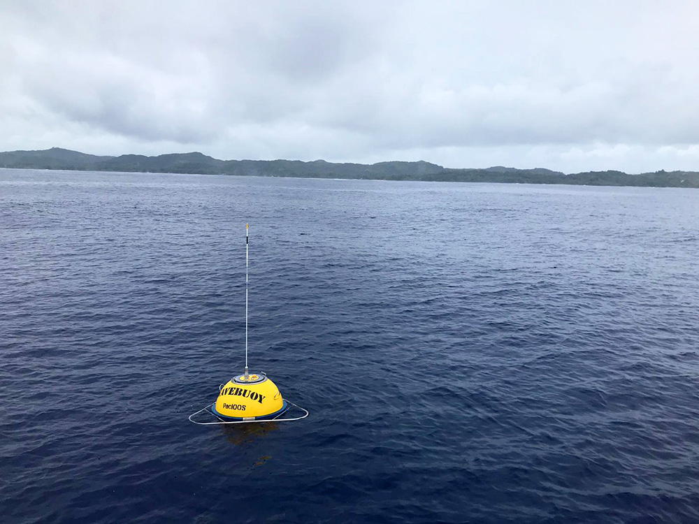
The PacIOOS wave buoy off Ngaraard (CDIP #219; NDBC #52212) measures waves at approximately 1.5 miles (2.4 km) offshore of Ngaraard state near the village of Elab along the northeast point of Babeldaob island in the Republic of Palau. Data are transmitted every half hour. Moored in water 105 meters deep, this Datawell Directional Waverider DWR4 buoy is equipped with three accelerometers measuring north/south, east/west, and vertical displacements, allowing it to measure both wave direction and wave energy.

Instrument site. Credit: PacIOOS/Andreia Monteiro Queima.
The Government of Japan, through the Enhancing Disaster and Climate Resilience (EDCR) project, provided the initial funding to purchase and deploy the Ngaraard buoy. The EDCR was implemented by the United Nations Development Programme (UNDP), in partnership with the Palau National Weather Service Office (NWSO) and PacIOOS (with additional funding support from U.S. IOOS and the U.S. Department of State). Data are managed by the Coastal Data Information Program (CDIP) at Scripps Institution of Oceanography of the University of California, San Diego (UCSD). Long-term partnerships between PacIOOS, the U.S. Army Corps of Engineers (USACE), and CDIP enable data streaming into the PacIOOS website and PacIOOS Voyager.
The PacIOOS wave buoy off Ngaraard, Babeldaob, Palau, also provides Sea Surface Currents Observations, Sea Surface Temperature Observations, and Air Temperature Observations in real-time.


