

PacIOOS Voyager Switched Servers
PacIOOS Voyager Switched Servers
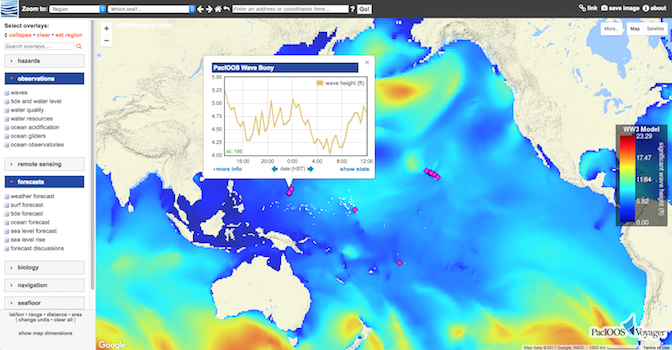
Posted April 6, 2017PacIOOS’ interactive mapping platform, PacIOOS Voyager, migrated to a new server behind the scenes. For quick and easy access, be sure to update your bookmarks to either http://pacioos.org/voyager/ or http://www.pacioos.hawaii.edu/voyager/. Redirects from the old server are in place temporarily.
On PacIOOS Voyager, users can view, combine, and download a large variety of coastal and ocean data sets. Real-time and archive observations, as well as forecast data from PacIOOS can be found, in addition to numerous layers from more than 50 partners and data providers. Customize your mapping experience and explore the Pacific Islands region!


