

New Wave Buoy In American Samoa
New Wave Buoy In American Samoa
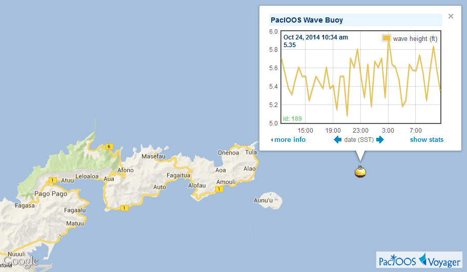
Posted October 24, 2014Yesterday, PacIOOS deployed a new wave buoy in American Samoa near Aunuʻu off the eastern coast of Tutuila. Moored in water 262 feet (80 meters) deep, this Datawell Directional Waverider buoy is equipped with three accelerometers measuring north/south, east/west, and vertical displacements, allowing it to measure wave height, wave direction, and wave period. It also measures water temperature at the base of the buoy, approximately 18 inches (45 cm) below the ocean surface. Data are transmitted every half hour and are now available through Voyager and Voyager Mobile as well as on the PacIOOS website.
Voyager screenshot of wave buoy 189 showing significant wave heights offshore of Tutuila, American Samoa (click here for larger image):
Wave buoy 189 is owned and managed by PacIOOS. NOAA’s Coastal Storms Program (CSP) provided the initial funding to purchase this buoy. Data are managed and distributed by the Coastal Data Information Program (CDIP).


