

Daily Archives: October 17, 2017
New Voyager Area Statistics Tool
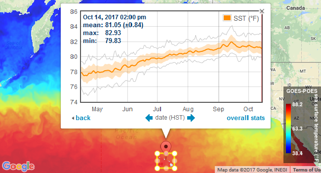
Posted October 17, 2017Voyager now provides a utility for computing statistics over a user-selected area for gridded datasets, including satellite data, forecasts (weather, surf, tide, ocean), bathymetry, and land elevation. This tool...
MUR Replaces G1SST Blended Sea Surface Temperatures
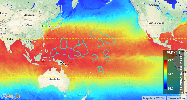
Posted October 17, 2017Voyager and Voyager Mobile now offer Multi-scale Ultra-high Resolution (MUR) sea surface temperatures (v4.1). These global, near real-time, satellite-derived data sets are available at daily and monthly time spans...


