

Regional Tsunami Model for Areas in Guam
Regional Tsunami Model for Areas in Guam
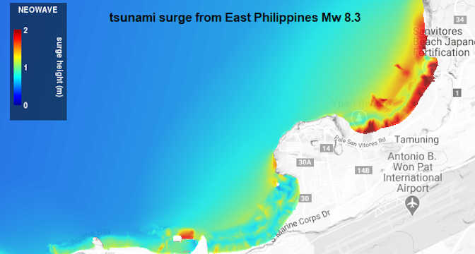
Posted January 19, 2021With funding support from NOAA’s National Weather Service and in partnership with the Guam Department of Homeland Security, Professor Kwok Fai Cheung, Department of Ocean and Resources Engineering at SOEST and PacIOOS co-investigator, along with his team developed a regional tsunami model for the Mariana Islands generating high-resolution hazards maps for various areas in Guam: Apra Harbor, Agana Bay, Tumon Bay, Agat Coast and Agat Marina.
The non-hydrostatic Evolution of Ocean WAVEs (NEOWAVE) regional tsunami models are categorized by earthquake magnitude and subduction zone. The data products include nearshore hazard maps of surge, drawdown, and currents for potential advisory and warning-level tsunamis from sources at the Mariana, Nankai, Philippine, and New Guinea subduction zones. The data are available for download in PacIOOS’ data catalog, with links to THREDDS and ERDDAP. Data sets for Hawaiʻi and American Samoa will be made available for download in the near future.


