

Hawaiʻi Bathymetry Overlay Now Clickable
Hawaiʻi Bathymetry Overlay Now Clickable
Posted July 17, 2013Voyager’s multi-color bathymetry overlay for the main Hawaiian islands is now queryable: clicking on the overlay will pop up a small window with the ocean depth nearest to the clicked location. In the window that appears, you can toggle between a variety of measurement units (meters, feet, fathoms, etc.). Also, links are provided to download the data in NetCDF format (either a subset or the entire grid), for visiting the dataset’s archive, or for accessing the overlay via interoperable standards like Google Earth (KMZ), Web Map Service (PNG), or Web Coverage Service (GeoTIFF).
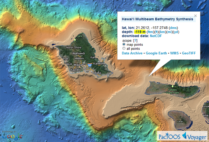
This overlay represents the 50-m resolution multibeam bathymetry synthesis produced by the Hawaiʻi Mapping Research Group (HMRG) of the School of Ocean and Earth Science and Technology (SOEST) at the University of Hawaiʻi at Mānoa. We have plans to supplement Voyager’s bathymetry category with datasets in other PacIOOS regions throughout the insular Pacific in the coming months.


