

Hawaiʻi Flood Hazard Zones Updated In Voyager
Hawaiʻi Flood Hazard Zones Updated In Voyager
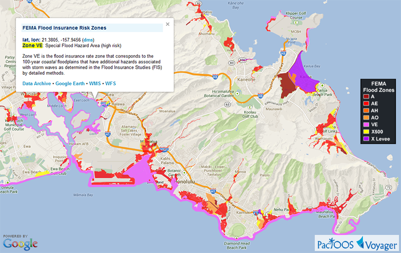
Posted November 8, 2013Federal Emergency Management Agency (FEMA) Flood Insurance Rate Maps (FIRM) for the State of Hawaiʻi are now updated in Voyager with the latest effective flood hazard zones. The publication dates of the underlying surveys are November 26, 2010 for the County of Kauaʻi; September 19, 2012 for the County of Maui; and January 19, 2011 for the City and County of Honolulu. FEMA is still assessing and digitizing flood hazard zones for the Big Island, so none are available there in the meantime.
Voyager screenshot of Oʻahu South Shore flood hazard zones (click here for larger image):
PacIOOS has generated a Web Map Service (WMS) and Web Feature Service (WFS) from the original Hawaiʻi Statewide GIS Program Shapefile. These interoperable Open Geospatial Consortium (OGC) standards will help users who may want to incorporate map imagery of this layer into other mapping applications: WMS GetCapabilities • WFS GetCapabilities.


