Insular Pacific Maritime Boundaries
Insular Pacific Maritime Boundaries
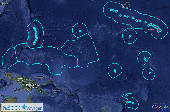
Posted April 12, 2013While previously limited to Hawaiʻi, Voyager’s “maritime boundaries” category has been spatially expanded to include our other PacIOOS regions throughout the insular Pacific. Using data from the NOAA Office of Coast Survey, the Exclusive Economic Zone (EEZ) is now provided for Hawaiʻi, American Samoa, the Commonwealth of the Northern Mariana Islands (CNMI), the Federated States of Micronesia (FSM), Guam, the Republic of the Marshall Islands (RMI), the Republic of Palau, and U.S. Minor Outlying Islands. In addition, the Territorial Sea and Contiguous Zone boundaries (12 and 24 nautical miles from shore, respectively) are provided for American Samoa, CNMI, Guam, and the U.S. Minor Outlying Islands. A Google Earth KML/KMZ file containing these boundaries is also available at http://pacioos.org/kml/maritime_boundaries.kmz.