New Tools In Voyager Mobile
New Tools In Voyager Mobile
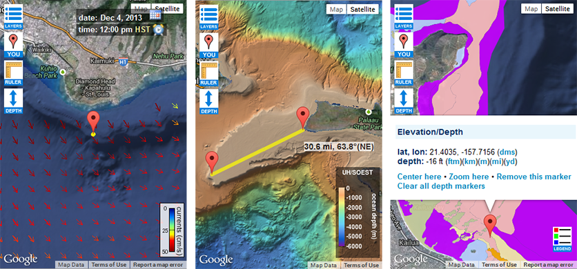
Posted December 4, 2013Three additional map utilities have been added to Voyager Mobile. These are provided as a set of buttons in the upper left of the map screen.
Users can now identify their current location to better orient themselves on the map. This feature utilizes the geolocation capabilities on many mobile devices and web browsers. The accuracy of the identified location can vary and is displayed along with a marker icon.
In addition, a ruler is provided to measure the distance between two locations. The ruler end points can be dragged to new places on the map or multiple rulers can be displayed.
Lastly, you can now click a point on the map to get its ocean depth or land elevation. This uses the Google Maps Elevation Service, which queries elevation data around the earth from a variety of sources.
Voyager Mobile screenshots L-to-R: User’s position offshore of Diamond Head with respect to surface currents; measuring the length of Penguin Bank; and identifying coral depth near Kailua:


