Tracking Wave Glider “Aʻa”
Tracking Wave Glider “Aʻa”
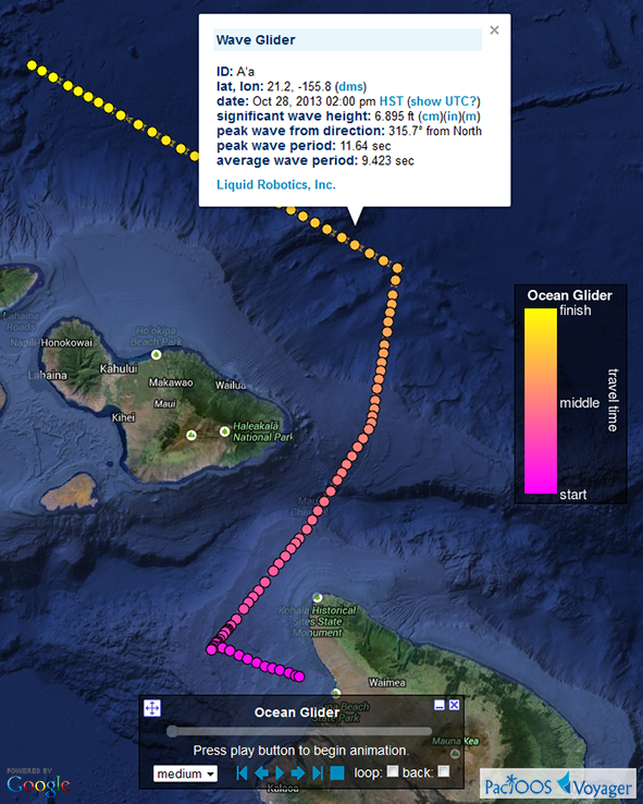
Posted October 30, 2013Track the new wave glider mission from Liquid Robotics, Inc. named “Aʻa” in near real-time as it makes its way to the Papahānaumokuākea Marine National Monument (Northwestern Hawaiian Islands). Starting off the leeward coast of Big Island on October 23, this unmanned ocean robot is transmitting measurements at the ocean’s surface as it makes its way north. It is heading towards NOAA/NDBC moored buoy 51101, 190 nautical miles northwest of Kauaʻi. Every half hour it records wave height, wave direction, and wave period. In addition, it also measures currents (direction and speed of the water’s motion) hourly at several depth levels.
You can follow Aʻa using the new “ocean gliders” category in PacIOOS Voyager. Use this to plot or animate the glider’s motion over time. Click on a location to see its wave measurements; likewise, the ADCP data (ocean currents) will be added soon. Check back for other improvements as we integrate additional features into our glider visualization over the coming weeks, including time series plots, depth profile plots, and color-coding the track by the observed wave heights, water velocities, and other properties.
Voyager screenshot of “Aʻa” wave glider October 23-30, 2013 (click here for larger image):