Nearshore Sensor Observations : Archive : Palmyra Atoll
This site has been decommissioned and is no longer collecting new data.
NOTE: Click on the plot below for data at a specific time.
NOTE: This instrument does not report in real-time. New data are retrieved periodically.
start date: : temperature: wave height: wind: rain: currents: site:
Disclaimer: Near real-time data have not been quality controlled.
Disclaimer: Data are released in compliance with real-time quality control standards.
Disclaimer: Real-time data are provided as raw and unaltered. Results of quality control checks are provided within the data set.
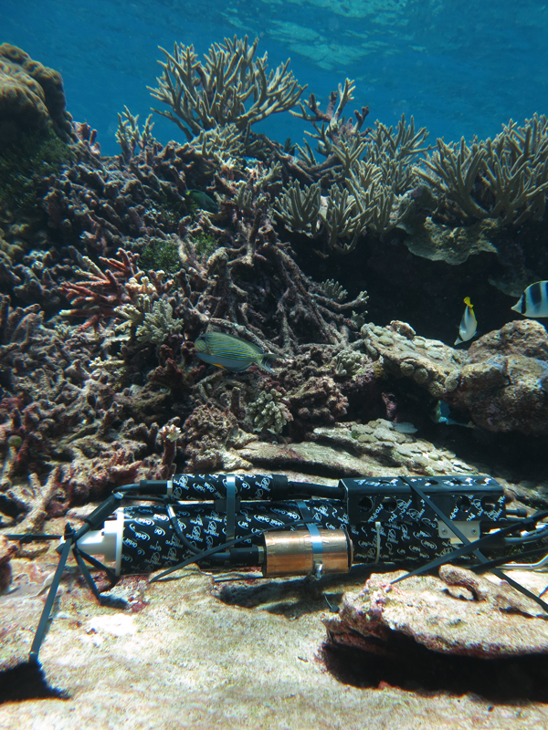
This nearshore sensor (nss_wqspp_003) operated for one year between October 2, 2017 and October 3, 2018. It was located approximately 350 meters southwest of Sand Island and 350 meters northwest of Penguin Spit along the western shores of Palmyra Atoll in the equatorial Northern Pacific Ocean. The sensor package was mounted to the sea floor at approximately 4 meters depth. Data were recorded every 7 minutes.

Instrument site. Credit: UCSD/Jennifer Smith.
The PacIOOS Water Quality Sensor Partnership Program (WQSPP) supports scientists and natural resource managers to collect water quality data in order to inform research, conservation, planning, and resource management projects in the U.S. Insular Pacific region. Comprised of a network of “roving” water quality nearshore sensors, the WQSPP provides participating partners with sensors, data management, and technical capacity-building to allow for robust data collection.
As part of the WQSPP, the U.S. Fish and Wildlife Service (USFWS), with the help of Dr. Jennifer E. Smith from Scripps Institution of Oceanography of the University of California, San Diego (UCSD), deployed one of PacIOOS’ nearshore water quality sensors at Palmyra Atoll National Wildlife Refuge to support reef recovery efforts. USFWS removed a large shipwreck from Palmyra Atoll in 2013. The shipwreck had devastating impacts on the reef as the wreck’s iron fostered the growth of corallimorph, an invasive organism that smothered a large amount of the once healthy reef. Over time, coral diversity diminished and the reef turned into a “black reef”, dominated by this single, invasive species. The successful removal of the shipwreck was followed by the removal of invasive species and the restoration of vital coral reef habitat. Post-removal surveys of coral growth, health, and recolonization were conducted, but drastic fluctuations in turbidity due to resuspension and occasional temperature elevations triggered seasonal coral bleaching. Data collected by the PacIOOS nearshore sensor helped to increase the understanding of oceanographic conditions and associated impacts for ongoing and future coral reef restoration efforts. Owned and maintained by PacIOOS under the supervision of Dr. Margaret McManus and lab.


