

Yearly Archives: 2017

Executive Committee and Stakeholder Meetings in Guam
Posted April 15, 2017The Executive Committee of the PacIOOS Governing Council met on Guam in April. Committee members, IOOS Director Carl Gouldman, and PacIOOS staff reviewed program updates and discussed the future...
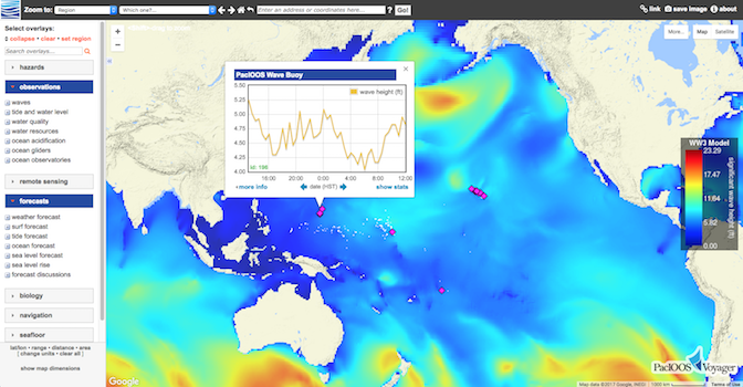
PacIOOS Voyager Switched Servers
Posted April 06, 2017PacIOOS’ interactive mapping platform, PacIOOS Voyager, migrated to a new server behind the scenes. For quick and easy access, be sure to update your bookmarks to either http://pacioos.org/voyager/ or...

Coral Reef Recovery at Palmyra Atoll
Posted March 30, 2017As part of the PacIOOS Water Quality Sensor Partnership Program (WQSPP), the U.S. Fish and Wildlife Service (FWS) recently entered into a Memorandum of Understanding (MOU) with PacIOOS to...
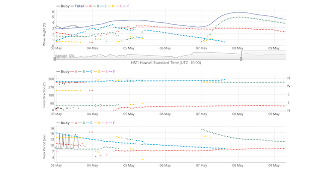
Dynamic Plots for Combined Wave Observations and Forecast
Posted February 15, 2017In response to user feedback, PacIOOS is now featuring new dynamic data plots that combine PacIOOS’ wave buoy observations with wave forecast data (see example for Waimea Bay). Spectral...
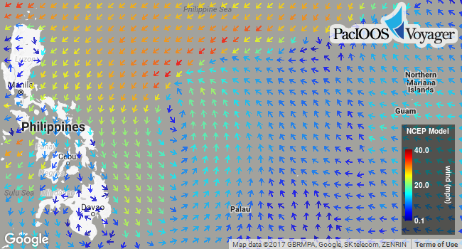
Higher Resolution NCEP GFS Weather Forecast
Posted February 07, 2017In addition to the 0.5° (~50-km) NCEP Global Forecast System (GFS) weather forecast, Voyager now offers a higher resolution Pacific subset of NCEP GFS at 0.25° (~25-km). This numerical...

JIMAR PacIOOS Job Opportunity: Data Applications Specialist
Posted January 03, 2017Partnering to support science and inform decision-making in the Pacific Islands JIMAR – Joint Institute for Marine and Atmospheric Research (in collaboration with NOAA PIFSC – Pacific Islands Fisheries...


