Daily Archives: May 21, 2018

news-roms-kaneohe

New Ocean Circulation Forecast for Kāneʻohe
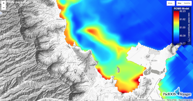
Posted May 21, 2018

PacIOOS’ Regional Ocean Modeling System (ROMS) now provides a new high-resolution grid for Kāneʻohe (approximately 100-m resolution) and the surrounding area along Oʻahu’s windward shore (1.5-km resolution). The model...

Read More >

Did you know?

PacIOOS is the first regional association that was certified as a Regional Information Coordination Entity (RICE) by the U.S. Integrated Ocean Observing System (IOOS). Certification provides NOAA and its interagency partners a means to verify that a regional association’s organizational and operational practices, including data management, meet recognized and established standards set by NOAA.