

Yearly Archives: 2016
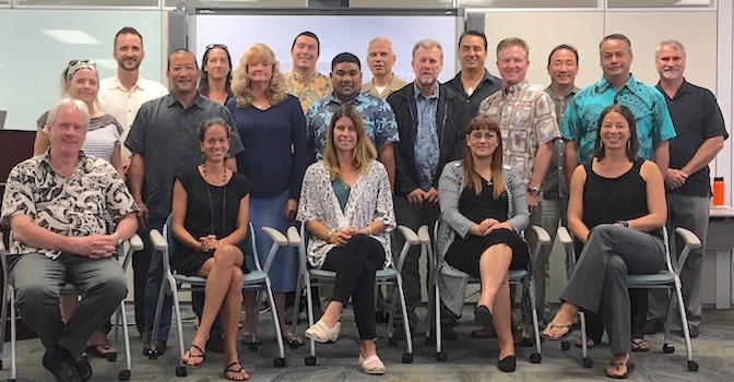
2016 Governing Council Meeting
Posted November 10, 2016Members of the PacIOOS Governing Council gathered for their annual meeting at the beginning of November. Following detailed program updates, discussions focused on the draft outline of PacIOOS’ revised...
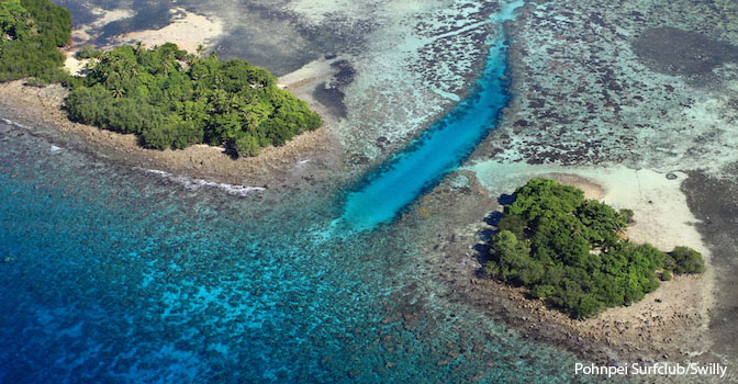
PacIOOS Sensor Informs Partners in Pohnpei, FSM
Posted October 27, 2016Effects of Environmental Parameters on Spawning Aggregation As part of the PacIOOS Water Quality Sensor Partnership Program (WQSPP), Dr. Kevin Rhodes of the Micronesia Islands Nature Alliance (MINA) is using...
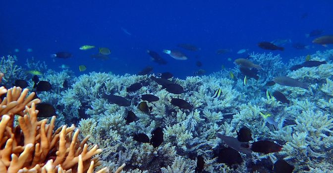
PacIOOS Water Quality Sensor Partnership Program
Posted October 26, 2016The PacIOOS Water Quality Sensor Partnership Program (WQSPP) supports scientists and natural resource managers to collect water quality data in order to inform research, conservation, planning, and resource management...
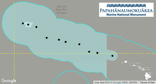
Papahānaumokuākea Expansion
Posted September 26, 2016On August 26, President Obama signed a proclamation expanding the Papahānaumokuākea Marine National Monument from 139,797 mi2 (362,073 km2) to 582,578 mi2 (1,508,870 km2). This extended the monument boundary...
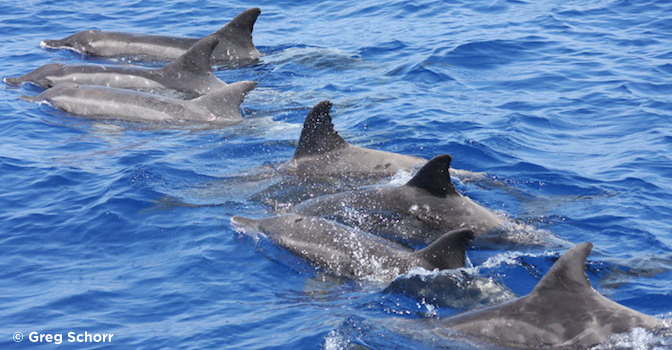
More Dolphin and Whale Tracks in Voyager
Posted September 19, 2016Cascadia Research Collective (CRC) researcher Robin Baird has provided PacIOOS with additional satellite tracking data of tagged Hawaiian dolphins and whales. Spanning 2013-2014 for the islands of Kauaʻi and...
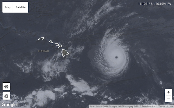
Tropical Storm Madeline and Hurricane Lester
Posted September 01, 2016**Update: The State of Hawaiʻi is no longer under Hurricane Watch.** Tropical Storm Madeline has weakened and is projected to move away from the main Hawaiian Islands. Hurricane Lester...
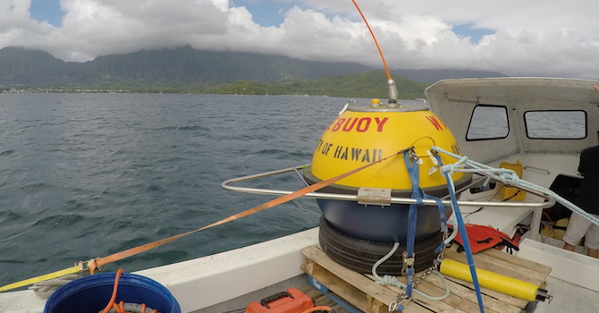
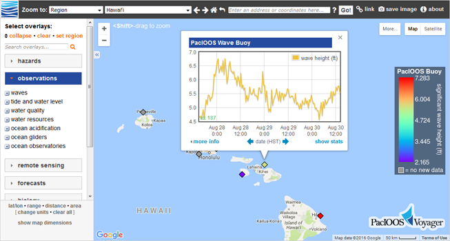
New Kāneʻohe WETS Wave Buoy Deployed
Posted August 31, 2016PacIOOS deployed a second wave buoy in Kāneʻohe Bay, Oʻahu. The buoy was installed as part of Hawaiʻi Natural Energy Institute’s (HNEI) efforts to test in-water wave energy conversion...
Voyager’s New Look & Feel
Posted August 30, 2016In conjunction with the launch of the new PacIOOS website, PacIOOS Voyager has been redesigned to mirror our new look and feel. All functionality remains the same but the...
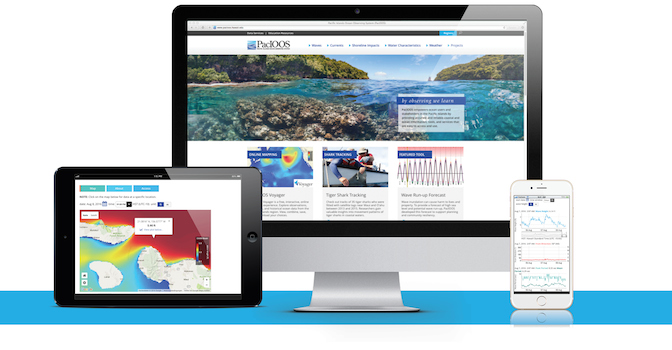
Launch of new PacIOOS Website
Posted August 20, 2016We are proud to announce the launch of the new PacIOOS website at http://pacioos.org. The goal of the new website is to further PacIOOS’ mission to empower ocean users,...
PacIOOS’ New Look & Feel
Posted August 01, 2016We are excited to share the new PacIOOS branding with you! Our goal was to develop a simple, clean, and memorable branding that captures what PacIOOS stands for: empowering...


